Category: Trail Info

Trails are logically distinct components. A trail can be ten meters long or 100,000 meters. Trail Info category indicates a post that has detailed specific information describing a particular trail. For posts describing a suggested route that uses one or more trails, use the Ride Route category INSTEAD.

Bike Trail to Tule

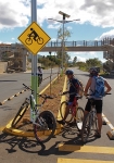
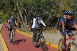
Oaxaca recently completed another section of the “Rails to Trails” project converting the old railroad line running from Oaxaca city to the town of Tule into a dedicated bicycle path. The latest addition takes bike riders to a point in Tule just a few blocks from the parish church where the famous gigantic cedar tree towers over the landscape. The newest segment is nicely paved and features solar-powered street lamps to light the path at night. While a portion of the new bike path shares the right-of-way with a four-lane road, the major part is well away from vehicular traffic. Unfortunately, the bike trail starts well away from the center of Oaxaca and may be difficult for some to locate – the bike path starts at the intersection of Ferrocarril and Norte Cinco.


Ixtlan de Juárez Ride

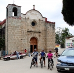
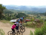
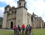
On a bright Saturday morning a group of friends, five in number, set out from Oaxaca city into the Sierra Norte, eager for a pleasant ride in the mountains. Looking for some place new, Ixtlan de Juárez seemed a good candidate for the day’s exploration.

A look at Google Earth shows a tantalizing network of dirt roads north of the town center. But as so often happens, the weather in the Sierra Norte did not match that in Oaxaca city. Where the Valles Centrales basked in sunshine, Ixtlan had a heavy cloud cover and intermittent light rain. We got in one satisfying loop, with a visit to the Mirador on the hilltop near town, before the clouds grew more threatening. We decided to break for lunch and zipped downhill on Highway 175 to the nearby town of Guelatao – famous as the birthplace of Benito Juarez. Just as we finished chowing down, the heavens opened up and we abandoned any hope of more biking in the afternoon.

While the ride shown on the map below is satisfying, it is rather short. However, you can zoom in and will see some of the dirt roads that excited our interest. If you have better luck with the weather, you will doubtless enjoy many additional miles of riding in the area.

Road LBR

Road LBR (Loma Blanco Road (White Ridge Road) is a dirt road used for access to the trails northwest of San Felipe del Agua. Colosio Park provides a safe place to park the car and ride from for access to Road LNR (Libramiento Norte Road) and the trails accessible from Road LNR, a San Felipe del Agua major (non-automobile, mostly) crossroad. This route from Colosio Park follows a rough dirt road that ends with a short climb that puts you on Road LNR. From there head east or west on this paved, but closed-to-autos road to access over 40 kilometers of trails.

Trail Parameters
Trail Type: Road
Trail Tread: Dirt Road
IMBA Trail Rating: White Circle – Easiest
Trail Length (km): 1.40
Trail Total Ascent (m): 64
Trail Total Descent (m): 24
Trail Maximum Elevation (m): 1712
Trail Minimum Elevation (m): 1658
Average Grade (%): 2.8
Use the “Download” link in the map above to retrieve a copy of the KML/Z file for your own uses. E.g. viewing in GoogleEarth, loading to your GPS-enabled device).

Or, click here to examine this trail and its components in greater detail in GoogleMaps.


Trail ZZ

Trail ZZ (Zig Zag) is a very short singletrack path of two switchbacks which provides a ridable route up from LNR (Libramiento Norte Road) to WFR (West Frontage Road) just north of the lower RR (Rojo Runout) + WFR trail junction. Useful for a shorter & easier climb up to WFR + RR Junction as compared to using either end of WFR (i.e. the north and south LNR + WFR Junctions). E.g. Trail ZZ is a easier shortcut up to Trails A, ED, Es, and RR from LNR. Handy for crossing from Trail TTT over to the aforementioned trails on the west side of LNR without having to descend on LNR to only re-ascend on WFR.

Trail Parameters
Trail Type: Trail
Trail Tread: Singletrack
IMBA Trail Rating: Blue Square – Difficult
Trail Length (km): 0.08
Trail Total Ascent (m): 8
Trail Total Descent (m): 0
Trail Maximum Elevation (m): 1887
Trail Minimum Elevation (m): 1879
Average Grade (%): 10.9
Use the “Download” link above to retrieve a copy of the KML/Z file for your own uses. E.g. viewing in GoogleEarth, loading to your GPS-enabled device).Or, click here to examine this trail and its components in greater detail in GoogleMaps.


Trail PC

Trail PC (Pierna Cojera (Lame Leg)) is a very short cut over between LLL (Larry’s Lacerated Leg) and V (Vela (Candle). Generally best avoided but if you make a wrong turn near the top of V you can find yourself on this.

Trail Parameters
Trail Type: Trail
Trail Tread: Goat Path
IMBA Trail Rating: Blue Square – Difficult
Trail Length (km): 0.14
Trail Total Ascent (m): 2
Trail Total Descent (m): 7
Trail Maximum Elevation (m): 1843
Trail Minimum Elevation (m): 1835
Average Grade (%): -3.4
Use the “Download” link in the map above to retrieve a copy of the KML/Z file for your own uses. E.g. viewing in GoogleEarth, loading to your GPS-enabled device).
 
Or, click here to examine this trail and its components in greater detail in GoogleMaps.