Category: Ride Routes

Information on places to ride your bike with route information (typically GPS and map), towns passed through, points of interest along the way, and maybe even photos

Ixtlan Revisited

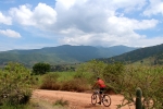
In November of last year (2013) we visited Ixtlan de Juarez. Unfortunately, cold, rainy weather cut short our exploration of the miles of logging roads that create a maze in the hills above the town. We returned yesterday (5 January 2014) in excellent weather and rode a very satisfying 11 mile (17.7 km) loop, beginning and ending at the main church in town.

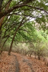
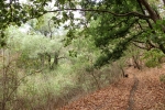
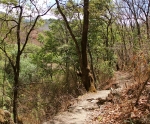
Except for the small portion on paved city streets, the entire loop is on dirt roads which are in relatively good condition and have decent gradient. There are numerous junctions with lesser trafficked logging roads (we stayed on what seemed to be the most-used road) along the route and a couple of single track trails that dropped off into the woods.

The loop can be ridden in either direction, but clockwise is recommended, as that way the grade going uphill is a  manageable 5.8%, whereas the descent averages a “Yee-haw!” 9% for a fast paced, brake-burning downhill run.

The ride begins in the center of town, at an elevation of 6505 feet (1983 meters) and tops out at 8556 feet (2608 meters). The total elevation gain pedaling 7.0 miles (11.3 km) to the top amounts to 2119 feet (646 meters), with a scant 33 feet (10 meters) of downhill along the way. The blistering 4.0 mile (6.4 km) descent is even more consistent, with a meager 20 feet (6 meters) of climbing thrown in for grins.

Give yourself a whole day to play in the forest and enjoy riding this and other nearby trails.

San Felipe del Agua to Ocotlan

If you want to stretch your legs, put in a good number of miles and enjoy some fine arts and crafts along the way, this ride from Oaxaca to Ocotlan may suit your fancy. You will rack up nearly 64 miles in the saddle if you follow this route, which takes the long (i.e. scenic) way to Octolan via back roads in the Tlacolula Valley to avoid traffic on the main highway going south out of town. Though the mileage is significant, most of the route is relatively flat — honest! However you get to Ocotlan, you will have to cross the ridge that separates the Tlocolula Valley from the Zimatlan Valley (on some maps called the Grande Valley) to the south.

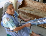
In Ocotlan you will want to stop at the Rodolpho Morales museum and visit the workshop of the famous Aquilar sisters. Either going to or coming from Ocotlan, you will pass right by the village of San Tomas Jalieza, where women use back-strap looms to weave apparel items, and San Martín Tilcajete, world-famous for the fanciful wood carvings called “alebrijes.” With stops to look at art and to have lunch, this will be an all-day excursion. Take your time and enjoy it! Your legs and rear end will appreciate getting some time off the bike.

Tlalixtac – Lower Mil Rios Trail

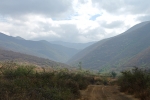
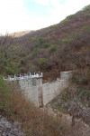
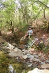
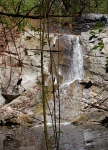
The small village of Tlalixtac lies 5.4 miles (8.7 km) east of Oaxaca city, a short distance north of the main highway to Tlacolula and Mitla. A number of good bike rides pass through this little town. This particular outing originates at the town square and proceeds on dirt roads and rocky singletrack up into a nearby mountain valley that provides water and firewood to the inhabitants of Tlalixtac. The road exists to service the four dams constructed in the lower part of the valley. Beyond the dams the path gradually diminishes until it is a narrow track through the forest — sometimes smooth and flowing; at other times studded with rocks. A skilled biker can ride the whole thing; average riders will likely have to hike-a-bike from time to time. There are fifteen creek crossings between the dams and the cascada at the far end of the valley (that makes 30 crossings out & back), but many are dry or have little water, depending on the time of year. There are no grand vistas to lure you up this trail, but you will surely enjoy the shady, winding path into the hills. This is also an excellent hiking trail, so feel free to ditch your bike and continue on foot if the going gets too intimidating for two-wheeled travel.

The distance from the Tlalixtac town center to the cascada is 13.7 miles (22.0 km) round trip, with an elevation gain and loss of 1283 feet (391 meters). If you choose to ride from the Zócalo in central Oaxaca (as shown on the second map below), you will accumulate a total of 24.5 miles (39.4 km) on the round trip, and the elevation gain & loss will amount to 2602 feet (793 meters).  Either option is a pleasant ride.

Tlacolula Loop

This loop ride comprises a tour through the open country on the southern side of the Tlacolula valley, linking Oaxaca with Tlacochahuaya and Tlacolula and skirting the mountains that form the southern rim of the valley.

Oaxaca Flume Trail

Another day out in the saddle riding with the local trail builder and guide, Carlos Silverberg. This time it was a full day grinding up and taking in The Oaxaca Flume trail. Starting from San Pablo Etla, it’s a short bit of rolling singletrack to reach the dirt road that is 95% of the ascent. The road will take you up the side of the mountain to the “La Mesita” park and then well beyond, climbing over 700 meters in about 8 kilimeters. Once you reach the junction with the singletrack, you work your way northward through pine trees on a skinny tread of trail that is thickly covered with dry pine needles. Elevation drops, but after each ravine crossing you can expect a brief climb before the more typical rolling flow across the ridges. The slippery pine needles and occasional rock band keep your attention, but the biggest challenge is just keeping your line on the thin trail as it traverses very steep slopes.

Eventually there is a sustained downhill (~1km) which leaves the pine forest behind and drops you into scrub oak. The trail utilizes an erosion-worn rut full of scree and blocks of rock…and in the dry season, lots of dry leaves (~15cm deep or more). No large drops but pretty much steady 15 – 30cm jumble of rock crud to plow the whole way down, with the occasional sharp turn and/or 20 – 45cm ledge or pile-o-crap to descend.

From there a ~0.75km climb up a steep slope with occasional breather breaks heads to the northwest and allows the trail to connect to the next big valley. The reward for the climb is an extension in the final descent, as the trail will cross back to the southern ridge as it winds its way back to the west on its return to the Etla valley.

The Oaxaca Flume trail’s namesake, the old hydroelectric facility’s water flume, is visible across the valley to the north as the trail heads west at this, its most northern point. The flume appears as a landscape scar running along the contour line across the far south-facing slope. As the trail dives down to the valley it follows a well-worn donkey trail that is full of the typical scree and baby-head boulders. Yum!

Once down out of the scrub oak and into the weeded fields and occasional corn-field, countless social trails crisscross the area — i.e. multiple options exist for routing your way home or adding extra kilometers. For this outing we headed across the small valley to the outcropping hill known as La Corona (The Crown) and ran down its eastern flank and on into San Pablo Etla for lunch before returning to our starting point.

I STRONGLY urge you to hire a guide the first few times you take on The Oaxaca Flume. Using the GPS, it would be easy enough to find the singletrack turn off from the Etla Ecopark dirt road, but the trail eventually crosses MANY intersections or heads through low, grassy vegetation that obscures the route. As noted above, the bottom part of the trail involves the massive network of social and improved trails near populated areas, but even though this would just lead to alternate routing/mileage, one could easily get totally lost in the middle sections of the trail. Besides, having a guide will have somebody giving you an idea of what to expect on the trail and allowing you to ignore navigation and totally focus on drinking deeply from The Oaxaca Flume trail.

Physical Rating: Difficult (A shuttle up the road would cut this to Moderate)
Technical (i.e. IMBA) Rating: Intermediate to Advanced / Blue Circle to Black Diamond