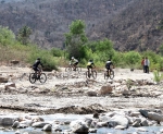
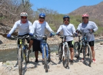
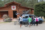
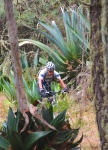
When people think of archeological ruins in Oaxaca, they picture ancient Indian cities, with palaces, temples, ball courts and such. There are other ruins, though, that date from the days of the Spanish conquistadores or more recent times.
It is recorded that the Aztec great speaker, Montezuma II, told Hernán Cortés that most of his gold came from Oaxaca state. Being the wily character that he was, Cortés arranged to have himself proclaimed the Marques de Valle, and so claimed most of Oaxaca state and a good bit of Vera Cruz state as his personal fiefdom. Then he – and the Spaniards who followed – set about searching for gold and silver. They found these mineral riches in the Sierra Norte mountains to the north of Oaxaca city, where they established mining operations. This bike ride explores the ruins of some of these mines in the valley of the Rio Papaloapam near the town of San Miguel Amatlan, one of the eight villages in the Pueblos Mancomunados that share their forest lands and promote eco-tourism.
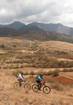
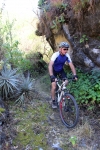
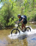
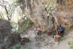
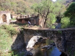
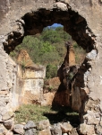
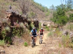
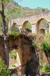
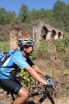
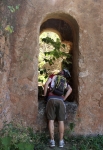
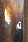
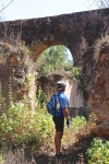
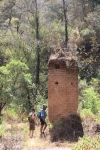
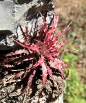
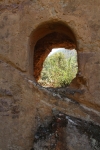
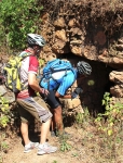
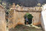
The journey begins at the eco-tourism office in Amatlan, where some hand-drawn maps provide an overview of the area and show which roads lead to the old mines and the haciendas that serviced them. The GPS map below shows a loop that follows a dirt road out of town, up and over a ridge and down into the river valley in the direction of Yavesia. After pedaling 8.5 km (5.3 miles) the imposing ruins of one of the mine facilities appears in the valley below, and can be easily accessed by an old service road. From that point on it is easy to follow the singletrack trail that courses along the bank of the river, passing from one intriguing ruin to another, crossing over several stone bridges. As the photos below indicate, there is quite a lot to see. The most notable structures are the stone aqueducts and the imposing buildings that once housed water wheels (some vertical and others horizontal) that powered the mine facilities. The size and complexity of the installations are readily apparent from the crumbling walls and foundations still visible. Be sure to bring a camera!
The route described is a loop which covers 10.2 miles (16.4 km), the first half of which (the southern part of the loop) covers 5.28 miles on dirt roads leading to the ruins. Most of the climbing (1347 feet / 410.5 meters) and descending (1061 feet / 323.4 meters) happens here. Once you reach the ruins, the trail pretty much follows the river, descending gradually another 626 feet / 190.8 meters over the course of 3.3 miles (5.3 km) to the lowest point (6035 feet / 1839.5 meters in elevation). From there it is a moderate climb back up the hill to Amatlan (a gain of 502.5 feet / 153 meters) in 1.7 miles / 2.7 km.
You should allow 2 hours drive time to reach Amatlan from Oaxaca city.
The ruins can also be reached by riding out & back from Amatlan, using just the last half of the loop (the northern part) described. This may actually be preferred, as it eliminates the biggest of the climbs and because you will find each of the hacienda ruins along the way more dramatic than the one preceding.
Cuando la gente piensa en sitios arqueologicos en Oaxaca, se imaginan antiguas ciudades Indigenas, con palacios, templos, juegos de pelota como tal. Hay otras ruinas, sin embargo, que datan de la época de los conquistadores españoles o tiempos más recientes.
La historia menciona que el gran orador azteca, Moctezuma II, dijo a Hernán Cortés que la mayor parte de su oro provino de el estado de Oaxaca. Siendo astuto como el era, Cortés se autoproclamo Marqués de Valle, y reclamo para si mismo la mayor parte del Estado de Oaxaca, y un poco del estado de Veracruz como su feudo personal. Despues el – y los españoles que siguieron – se establecieron ahi en la búsqueda de oro y plata. Encontraron estas riquezas minerales en las montañas de la Sierra norte, al norte de la ciudad de Oaxaca, donde establecieron operaciones mineras. Este paseo en bicicleta explora las ruinas de algunas de estas minas en el valle del Río Papaloapam cerca de la ciudad de San Miguel Amatlán, uno de los ocho pueblos de la pueblos Mancomunados que comparten sus tierras forestales y promueven el ecoturismo.
El viaje comienza en la oficina de turismo ecológico en Amatlán, donde algunos mapas dibujados a mano proporcionan una visión general de la zona y muestran que los caminos conducen a las antiguas minas y las haciendas que les sirvieron a ellos. El mapa GPS muestra un bucle que sigue una camino de tierra fuera de la ciudad, y sobre una cresta y hacia abajo en el valle del río en dirección a Yavesia. Después de pedalear 8,5 kilometros (5,3 millas) de las imponentes ruinas de una de las instalaciones de la mina aparece abajo en el valle, y puede ser fácilmente se accesado por un camino antiguo de terraceria. a partir de ahí es fácil seguir las veredas que va a lo largo de la orilla del río, pasando de una ruina intrigante a otro, cruzando varios puentes de piedra. Como las fotos siguientes indican, hay mucho que ver. los edificios más notables son los acueductos de piedra y los imponentes edificios que una vez albergó las ruedas de agua (algunos vertical y otros horizontales) que alimentaba las instalaciones de la mina. El tamaño y la complejidad de las instalaciones son fácilmente evidentes a partir de las paredes se desmoronan y fundaciones todavía visibles. Asegúrese de llevar una cámara!
La ruta descrita es un bucle que cubre 10,2 millas (16,4 km), la primera mitad de los cuales (la parte sur del bucle) cubre 5,28 millas de caminos de tierra que conducen a las ruinas. La mayor parte de la escalada (1.347 pies / 410,5 metros) y descendente (1.061 pies / 323,4 metros) que pasa aquí. Una vez que se llega a las ruinas, el camino sigue más o menos el río, descendiendo poco a poco otros 626 pies / 190.8 metros a lo largo de 3,3 millas (5.3 kilómetros) al punto más bajo (6.035 pies / 1839.5 metros de altitud). a partir de ahí es una subida moderada de vuelta a la colina a Amatlán (una ganancia de 502,5 pies / 153 metros) de 1,7 millas / 2,7 kilometros.
Debes considerar 2 horas de manejo para llegar a tiempo a Amatlán desde la ciudad de Oaxaca.
Se puede llegar a las ruinas también, utilizando sólo la última mitad del bucle (la parte norte) descrito. En realidad, esto puede ser preferible, ya que elimina la mayor de las subidas y porque se encuentra cada uno de las ruinas de la hacienda a lo largo de la forma más dramática que la anterior.
Like this:
Like Loading...
