Category: Outing

A description of a particular event or day out and about having DONE something. Outings are things that have occurred. Trails & Ride Routes are conceptual items that can be used by others to plan and complete their own outings.

Riding With The Nitos Group Again

First of all, a word of explanation as to why there has been no mention of the Nitos Ciclistas En Movimiento mountain bike club on this web site the past many months.  Nitos got started about four years ago and quickly developed a reputation for regular Sunday morning rides. Their outings were announced on the club’s Facebook page on Saturday and typically attracted twenty or more riders each week. Then suddenly, in February of 2017, no more Facebook postings appeared. Some feared the club had disbanded. It turns out, though, the group was using a different Facebook page — one this author was not aware of. So for the past year I have been missing out on a host of fun rides. Finally, a friend clued me in on what had happened. Now I know to check this address to be advised of Nitos’ rides:  https://www.facebook.com/nitosoaxaca/

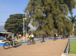
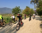
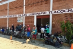
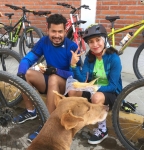
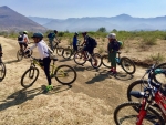
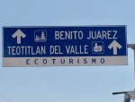
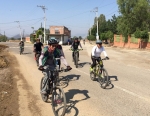
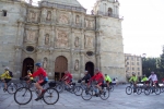
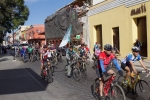
So here it is a bright Sunday morning in Oaxaca in early April and the Nitos group is planning a ride from el centro to the presa near Teotitlan del Valle and back. Twenty-four eager cyclists are gathered at 8 am in front of the church of Santo Domingo. After some gentle warm-up exercises, the band mounts up and takes the bike lane to Tule, then heads cross-country on dirt roads through Lachigoló, Tlacochahuaya and Macuilxochil on the way to Teotitlan. The group is a good mix of men and women, ranging in age from mid-teens to mid-70’s, with most riders comfortably in their 20’s and 30’s. The leaders set a moderate pace, with frequent brief stops to let the slower riders catch up. The terrain in the Tlacolula Valley is pretty flat, with an elevation gain and loss of little more than 500 feet (152 meters) so the pedaling is easy. The riders cover the 20 miles (32 kms) to Teotitlan in about three hours, then stop for lunch at the picnic area just recently built on the shore of the lake. The return to Oaxaca is even easier, as it flows gently downhill almost all the way. 

Oaxaca to Panama Ride

For the second year in a row a French cycling club has set up a weeks-long cross-country ride from Oaxaca to Panama. Working with local tour guides Pedro Martinez and Nicolas Garcia, the group of 40 Frenchmen set out from Oaxaca at 9 am on Sunday, 29 January with a police escort and accompanied by riders from the local Nitos Cyclistas En Movimento mountain bike club. On the first day of their epic ride they planned to stop briefly in San Bartolo Coyotepec, Tilcajete and Ocotlan de Morelos, finishing for the day and staying overnight in Ejutla. Over the next several weeks they will pedal through the states of Oaxaca and Chiapas and tour the Yucatan Peninsula before riding through Belize, Guatemala, El Salvador, Honduras, Nicaragua and Costa Rica before reaching their destination of Panama City, Panama. 

Report From Up North: Mountain Biking In Moab

Larry and Deron, the administrators of this web site, have returned to their Colorado homes for at least part of the summer. The purpose of this posting is two-fold:  to report on mountain biking beyond the Valley of Oaxaca and to show that this web site is alive and well, even in their absence. 

For twenty years the Rocky Mountain Bicycle Boys, a Denver-based club, have been making an annual pilgrimage to Moab to kick off the summer riding season, and 2016 was no exception. This year thirteen members of the group made the journey –somewhat fewer than in past years, but still a good representation. The weather gods were generous this year, providing excellent conditions for the occasion. Temperatures were mild and there were no fierce winds, dust storms or thundershowers to interfere with the joy of riding the awesome trails and taking in the magnificent desert scenery of the area.

Back in the 1980‘s when mountain bikes were a new-fangled invention, all of the trails around Moab were laid out by 4×4 off-road enthusiasts who delighted in testing their mettle driving the rugged terrain. So in those years cyclists pedaled alongside Jeeps and motorcycles on such challenging routes as Amasa Back, Hurrah Pass and Flat Pass. In recent years, though, local mountain bike clubs have teamed with the Bureau of Land Management (BLM) to create a dazzling network of new trails designed for and limited to mountain bikes. This year we rode the Moab Brands and the Navajo Rocks loops, both of which are new areas to be explored. Kudos to all the volunteers whose dedicated work paid off so spectacularly!

For a comprehensive map of the bike trails around Moab, click here.

Western Etla Valley Foothills

Sunday, March 13th was a day of clear skies and warm temperatures.  D.,  C., C., P., and E. met up on the highway out Etla way to explore some of the network of paths, trails and dirt roads on the western side of the Etla valley in the scrub-brush covered foothills that sit between the toll highway to Puebla / Mexico City and the pine-covered mountains.

Donaji Parque del Bosque

Out for a ride over to Huayapam from SFdA with Spencer and Alex when Alex noticed the Donaji forest guard house had its gate open and what appeared to be a new collection of exercise equipment.  Well, sure enough, the whole place has been improved recently.  It may be old news to most of you, but there is new zipline across the ravine, an area filled with a playground and exercise equipment, and picnic areas.  More importantly, the staff at the entrada now welcome visitors ..gratis!

We signed in to the visitors book and rode up the valley to an atypical oasis of pine trees, about .7 mile up the dirt road.   On the south side of that patch of pine trees, there is a new, benchcut trail that heads back down towards town, though now you’ve crossed over the ravine that is normally a PITA to get across.  It would be even easier if they’d let you use the zip line. 😉   But, at least for west-to-east travel, it’s all ridable and even has a nice section of singletrack to end the detour/alt route. No idea yet how the staff would react to bikers going east to west and coming OUT by the guard house.  But regardless which way you go, stop and tell them thank you for building new trail…that generally follows the contour line…except for the very end as it drops to get to the zipline end-station. Maybe offer up a cash donation and ask them to build more trail…perhaps something pushing further up the valley and connecting with the trails above on the west slope of the valley.