Category: MTBing

Items related to actual riding of mountain bikes.

Es tu nombre Raphael?

I went out yesterday to re-examine the trail I found Sunday. It runs pretty much with the contour line between Trail M (Mechero / Burner) and Trail Ma (Martillada / Hammerblow) but I wanted to make sure my initial glee of discovery hadn’t cloud my assessment of the ridability of it. This trail Larry had told me about months ago when he rode it with Dr. Z. Yet, we could never seem to locate it. In fact, I’m still not sure this thing is the same one Larry and Dr. Z rode together months ago.

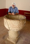
But, while out on my re-examination ride on Tuesday, I was fortunate to run into another rider I had met once before on the trail. If I have his name right and am spelling it correctly, his name is Rafael. Here is the only picture I have of him.

Mr. SecretSingletrack

Mr. SecretSingletrack

With our limited grasp of each other’s native languages (his grasp better than mine), we did our best to talk biking and trails. In that “conversation” Rafael said he could show me a trail up ahead coming off of Trail HFR, where we had crossed paths. I gladly agreed. My reward was the tightest, twistiest, most narrow, most vegetated yet rideable trail I’ve found here to date.

MUCHO MUCHO MUCHO GRACIAS, Rafael! It was a total blast and I can’t wait to do it again. Hopefully, once again chasing Rafael, as he is a fast rider who seems to share my taste for tight, twisty singletrack downhills.

Here is a map of the new (to me) trail Raphael showed me. I’m hoping to see him again and get the proper name of the trail. For now, its temporary name is Trail_CodeName-Rafael. On the map, it’s the red track. I’ve also include Trails HFR, M, and T to give perspective on where Rafael took me out in the woods to watch me fall on my head (only once, mind you!).

Oh, and since the multi tracks throw off the elevation profile, note that it’s about 1.1km long with an elevation drop of 183m. Tasty!

[ edited 2012-11-17 @ 00:05 to correct incorrect spelling of Rafael ]

Santo Domingo Tomaltepec – Krotalus Bike Shop Ride

This ride goes from the Krotalus Bike Shop in Oaxaca city (Calle Sabinos 309-B in Colonia Reforma / www.krotalusmtb.com.mx) through Tule and Santo Domingo Tomaltepec, then upvalley past two reservoirs and into bush country. Once past the lakes, the trail repeatedly crosses a stream (seven times going in; same coming out), making for a splashing good time – especially fun in hot weather! Caution: There is a large difference in the depth, width and speed of the water in the stream between the dry and the rainy season! Where the water may be only a couple of inches deep in the winter months (or the creek completely dry), it may be a foot deep in the summertime if rain has been plentiful.

The ride covers 23.5 miles (37.8 km), with an elevation gain & loss of about 1000 feet (378 meters). Though a relatively long ride, there are no steep grades to climb, just a steady, mild uphill to the end of the trail.

The (Re)discovery of a painfully obvious trail

Stumbled across a new trail today.  Expect a new Trail Info page for it next week (after other projects get done).  I think this might be the trail Dr. Z showed Larry months ago, yet one we could never find again.  It runs pretty much along the contour line between lower Trail Ma and Trail M.


Jalapa del Valle Ride

This is a fun, scenic and somewhat demanding ride from the Zocalo in downtown Oaxaca city through rolling countryside to the village of Jalapa del Valle and back.   It is essentially and out-and-back ride with a loop at the far end. All of the ride is accomplished on paved city streets, paved two-lane highway or dirt country roads. (Sorry, no singletrack!).

We started from the Zocalo in El Centro and concluded the ride by returning our rental bikes to the Zona Bici shop (Calle Garcia Vigil 406-1, just a couple of blocks north of the Zocalo). The distance covered is 27.5 miles (44.25 km), with an elevation gain of 2686 feet and a loss of 2566 feet (+ 818 / – 782 meters). I would rate this ride as moderately difficult, given its length and the steep grade of some of the hills.


Oaxaca Flume Trail

For the first of the Weekly Thursday Rides, we headed over to San Pablo Etla to see if we could find some of the singletrack trails Carl Silverberg and his amigos have been building. Not only did we find some new singletrack (new to us, that is), I also got to meet Carl. He is a super nice guy who’s done a lot to bring attention to Oaxaca mountain biking AND to work with the communities here to create and maintain more mountain-bike-friendly singletrack. I’m hoping to get back over to Etla and ride with Senor Silverberg soon. We are also planning to get over there for some trail work as the rainy season has, of course, affected those trails, too.

Carl’s MTB-guide company is on the Web at www.MountainBikeOaxaca.com

Here is the track Larry and I took yesterday. Note that many of the “wiggles” are due to us scouting singletrack at various trail junctions. Looks like there are lots of riding options in the Land of Carl(os) S.