Category: MTBing

Items related to actual riding of mountain bikes.

Invitational Ride At San Antonio de la Cal


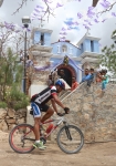
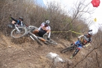
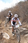
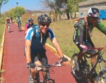
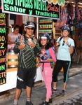
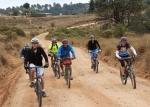
The community of San Antonio de la Cal, a suburb on the southeastern edge of Oaxaca city, sponsored a mountain bike ride today — Sunday, 18 January 2015 — and sent out a general invitation to riders and mountain bike clubs to come. Several bike clubs from Oaxaca took part, as did others from around the Oaxaca valley. Approximately 140 riders gathered at the municipal building in Experimental to register at the start of the ride. Then it was off for a ride on city streets and jeep trails in the hills nearby! The day concluded with a hearty free meal for all participants provided by the community.
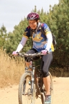
For riders who started from the Zocalo in Oaxaca, the day’s adventure racked up a total of 18.9 miles (30.4 km). Pedaling up and down the steep, rocky hills above La Cal — where the gradient ranged from 12% to 16% — brought the elevation gain and loss for the day to 1978 feet (602.9 meters).

Special thanks to Porfirio Santos Matías and Lic. Pedro Isidro Santos Matías, the head of the sports department in San Antonio de la Cal, for organizing the event; and to all the people who helped make it a success!

San Antonio de la Cal que es una comunidad a la periferia sureste de laciudad de Oaxaca patrocinó un evento de ciclismo de montaña el domingo 18de enero 2015. Ciclistas y clubes de ciclismo del valle central recibió unainvitación para participar. 140 ciclistas llegaron al edificio municipal enExperimental para inscribirse al evento. Luego comenzamos nuestro paseopor las calles de la ciudad y las sendas de terracería en las colinas cercanas. El día terminó con una comida para todos los participantes que la comunidadSan Antonio de la Cal muy amablemente nos brindó. Para los ciclistas que salieron del Zocalo en la ciudad de Oaxaca, el paseo arribade San Antonio de la Cal era de 18.9 millas de colinas con pendientes muyinclinados y rocosos y de una altura de ida y vuelta de 1978 pies (602.9 metros)


Nitos Ride Near Santo Domingo Tomaltepec

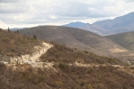
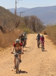
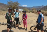
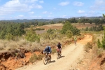
This second Sunday in January proved a fine time for the Nitos bike club to resume their Sunday morning rides after taking a break during the Christmas holidays. The destination for the day’s outing was the mountain valley upstream from Santo Domingo Tomaltepec, a small farming village in the Tlacolula valley that is one of the oldest settlements in the region. The dirt road that winds up the valley is picturesque and most famous for the seven creek crossings encountered before the road ends and a footpath (not suitable for biking) continues into the hills.

The thirty participants in today’s ride accumulated 23.6 miles (38 kilometers) riding out and back from the center of Oaxaca city. The terrain was mostly flat, so the group gained just 842 feet (256.6 meters), reaching a high point of 5718 feet (1742.8 meters) before turning back.

El segundo domingo en enero era un día ideal para el Club de Ciclismo a reanudar sus paseos matutinos  de domingo después de un descanso durante los días festivos de fin de año.  El destino era el valle dentro las montañas aguas arriba de Santo Domingo Tomaltepec, que es un pueblo en el Valle de Tlacolula y uno de los asientamientos más antiguos de la región.  El camino de terracería en el valle es pintoresco y afamado por sus siete cruces de arroyos. El fin del camino se desemboca en una senda que conduce dentro de las colinas pero no es adecuado para ciclismo.

Los 30 participantes  viajaban 23.6 millas (38 kilometros) del centro de la ciudad y regreso.  La ruta es casi todo plano asi que el cambio de altura era de 842 pies (256.6 metros) alcanzando una altura de 5718 pies (1742-8 metros) antes de regresar a la cuidad de Oaxaca.

OAXMTB YouTube Channel and First Trail Video

Two bits of news, campers:

1) Trail work on “Vela” is done and the trail is ride ready.  The upper part is still a bit thick with grass on the tread, but it opens up as you reach the middle and bottom.  Get out an ride it as the more it gets used, the better it will roll.

2) I finally got around to trying out my new GoPro knock-off video camera – an MHD (MonoPrice) Action Cam.  Earlier efforts using the chest harness were a total fail (unless you’d enjoy watching the trail tread go by with my knees wobbling around).  First halfway watchable video that I made is from a run down the freshly cleared “Vela” trail.  The video starts on Trail LLL, runs the bit of Trail PC that is used to get to Vela, and then ends as the 1 5meter walkout at the end of the trail where it pours back onto Trail TTT (aka Pista las carnívoras). The lighting is poor, there is a smudge on the camera lens, and I’m not sure I really like the handlebar mount perspective, but this is an experiment for now….


On that note, and with the hope that we will be able to provide a full collection of trail videos eventually, OaxacaMTB.org now has a YouTube channel to share these videos as they are created/provided.  That also means there is now a Google+ page to go along with our previously existing Facebook page.  We hope you’ll add these additional outlets to your social media lists.   Here are the links:


OaxacaMTB YouTube.com Channel

OaxacaMTB page on Google+

Nitos Ride on San Felipe del Agua Trails

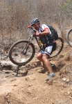
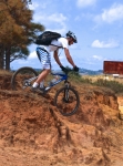
For this Sunday’s ride the Nitos bike club tried something different. Carlos, an experienced rider and mountain bike racer, was asked to accompany the group and give basic instructions on mountain biking along the way. He did a very thorough and professional job — starting with how to get a proper bike fit and how to set up the bike; then going on to give riding tips and demonstrating how to ride, climb and descend. Various segments of the San Felipe trail network provided the backdrop for Carlos’ instructions and the terrain for participants to practice using his advice.

The ride began, as usual, at the Church of St. Augustine in el centro. Riders used city streets to climb to San Felipe, where they set off on dirt roads and single track trails that continued on into the foothills of the Sierra Norte below Cerro San Felipe. The ride totaled 13.1 miles (21.1 km) and had an elevation gain and loss of 1690 feet (515 meters).

Este domingo el Club Nitos decidió intentar algo diferente. Carlos, un ciclista de mucha experiencia, nos acompañó y ofreció instrucción básica sobre ciclismo de montaña durante el viaje. Carlos fue un excelente guía y muy profesional—empezando con como escoger subicicleta y como equiparla luego dió consejos y él mismo mostró como elciclista se debiera montar, subir y descender durante un paseo o una carrera.Varias partes de la red de San Felipe se prestaron un terreno muy adecuado para que los participantes podían practicar lo que él enseñaba.


Nitos Ride to Huayapam

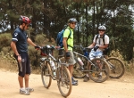
Twenty-five members of the Nitos club set out this Sunday morning for a ride along the lower flank of the Sierra Norte, following roads and trails running from San Felipe del Agua through Donaji and into Huayapam. The circular route ran a total of 15.0 miles (24.1 km) through some steep and heavily wooded terrain, with an elevation gain and loss of 1747 feet (532.5 meters) along the way. Weather conditions were excellent, and for the first time in a long while there was no mud to slither through. The group set out from downtown Oaxaca shortly after 8 am and finished the ride back at our starting point by 1:30 in the afternoon.

25 socios del Club Nitos emprendieron un viaje a través del costado de la Sierra Norte viajando por carreteras y caminos pasado por Donaji y terminando en Huayapam.  La ruta de ida y vuelta era de 15 millas (24.1 kilometros) y pasó por áreas de empinados caminos y bosques, con un cambio de altura de 532.5 metros durante el viaje.   Las condiciones de clima y terreno eran excelentes y por primera vez en algún tiempo no había lodo.  El grupo salió del centro de Oaxaca a las 8 de la mañana y terminó el viaje donde habíamos comenzado a la 1:30 de la tarde.