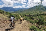
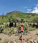
For weeks on end the Central Valley of Oaxaca has been smothered in a thick grey haze, likely caused by forest fires in March and early April. On most days one could not see the mountains from one side of the valley to the other. Finally – almost miraculously – a clear day dawned on Sunday, 31 May. With blue skies overhead and nary a remnant of the smog-like blanket, five bikers set out to ride from Oaxaca to Teotitlan del Valle and back. Two of the number, Tonio and Todd, were first-time riders with this group, which normally consists of retired expats who live full-time in Oaxaca. All were cheered by the crisp, clear air and eager for a great pedaling experience. Setting out at 8:30 am from the plaza in front of the church of Santo Domingo, the riders followed the paved bike path to Tule, then continued eastward on country roads to Tlacochahuaya and Dainzu before veering to the north through Macuixochitl and Teotitlan to the reservoir just north of town. It was a perfect day for such an outing. The full round-trip distance amounted to 39.6 miles (63.7 kms), with an elevation gain and loss of 1086 feet (331 meters) along the way.
Category: MTBing
Countryside, GPS, MTBing
Over Hill And Dale
by Larry • • 0 Comments
It seems the rainy season has gotten an early start in Oaxaca in this spring of 2020. We have had multiple rain showers in the late afternoon and evening these first two weeks of May, some of them quite heavy. These frequently leave large puddles on city streets and a good deal of mud on country roads. It is not difficult to sweep around these, but inevitably our bikes and riding clothes are splattered with mud by the end of a ride. Such was the case on this Wednesday outing, which was intended to be a big loop ride beginning in San Felipe del Aqua, proceeding south through Oaxaca and skirting past San Bartolo Coyotepec, before climbing over the ridge of hills into the Tlacolua valley and returning to Oaxaca. However, things did not go as planned. Once into the hills outside San Bartolo no one could remember the route and we got lost in the maze of dirt roads in the area. After several false starts, we turned back and headed for home, satisfied to have put in several hours in the saddle.
Countryside, GPS, MTBing, Photos
Huitzo Or Bust
by Larry • • 0 Comments
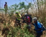
In the mood for a significant ride through unexplored territory, five mountain biking buddies set out this fine Friday in early May to pedal from Oaxaca city to San Pablo Huitzo. On the outbound leg of the journey, they traveled first to Atzompa, then headed in a northwesterly direction through San Lorenzo Cacaotepec, Matadamas, Soledad Etla and Nazareno Etla to Santiago Suchilquitongo. This route took them along a series of unpaved country lanes, beneath the toll road to Mexico City and well out into the relatively flat countryside of the Etla Valley. The planned destination was the restored monastery in Huitzo, or perhaps even the large reservoir not far beyond the town. However, one of the party was on a borrowed bike that turned out to be in serious need of maintenance. Approaching Suchilquitongo both the bearings in the bottom bracket and those in the rear hub gave out, necessitating an unscheduled stop at a bicycle repair shop there. The group took advantage of the stop to enjoy a tasty lunch of memelitas. With tummies full and the wounded bike operational again, our intrepid gang decided to head back to Oaxaca, riding along the abandoned railway line that once linked the Valley of Oaxaca with Mexico City and the United States. Though the rail line was still in place (and can be traced on the map below), it was badly overgrown in several spots and so a good amount of bushwhacking ensued. This, in turn, resulted in multiple thorn punctures in everyone’s tires. Happily, all but one rider was running tubeless tires filled with sealant, so only two flat tires had to be dealt with. All in all, the ride was hailed a success. The weary bikers returned home after spending eight hours in the saddle, covering a round-trip distance of 48.3 miles (77.7 kms). Though the terrain was relatively flat, there was nevertheless an elevation gain and loss of about 2100 feet (640 meters) on the circuit. The map below shows only the outbound half of the trip, as the batteries in the GPS unit gave out while the group was stopped for lunch. The return journey followed a roughly parallel path back to Oaxaca.
Countryside, Foothills, GPS, MTBing, Photos
Pedaling Through The Pandemic
by Larry • • 0 Comments
The year 2020 will go down in history as the year of the coronavirus pandemic. Since late February the whole world has been turned topsy-turvy by news of and reactions to the latest esoteric virus to come out of China. As of this writing (30 April 2020) 3.2 million people have contracted Covid-19 world wide, and there have been over 225,000 deaths. Citizens in countries around the globe have been ordered to stay at home and national economies are tottering toward collapse. Thankfully, the health situation is not so dire in Oaxaca, though the local economy, which is heavily dependent on tourism, is reeling. These are tough times, indeed!
Happily, mountain biking provides a welcome respite from the coronavirus crisis. It is not difficult to maintain social distance while pedaling through the countryside; and spending time in the saddle is both great exercise and a big psychological boost. So it is that small groups of friends, including a number of retired expats who call Oaxaca home, meet several times each week for rides on nearby mountain trails or around the central valley. On this particular Thursday morning, four amigos rode 21.6 miles from Oaxaca up to San Felipe del Agua, then over the mountain ridge to Viguera and on to San Pablo Etla before returning to town along the abandoned railroad line that once linked Oaxaca with Mexico City to the north and the Pacific coast to the south. The relative lack of vehicular traffic on city streets is a side benefit of the pandemic, as is the better air quality.
Countryside, Foothills, GPS, MTBing
Lobera Loop
by Larry • • 0 Comments
The world is in the grip of the coronavirus pandemic in mid-April of 2020. The city and state of Oaxaca are yet to be hit with significant numbers of Covid-19 infections, but people are on edge. There are virtually no flights in or out of Oaxaca; tourists are non-existent; most businesses are closed; and large numbers of citizens are out of work. Folks are hunkered down in their homes and social distancing is the norm. All the more reason, then, to climb aboard our mountain bikes for a rejuvenating morning ride through the countryside of the Zimatlan valley. Fresh air and exercise are great antidotes for feeling depressed. So four expats living in Oaxaca set out on a pleasant 26.7 mile (43 kms) loop ride on a bright Saturday morning, aiming to pedal to the little village of Lobera and back. The outing took just over three hours, with riders gaining and losing a total of 1203 feet (367 meters) in elevation along the way.


