Category: Mountains

High Country Ride at El Carrizal

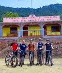
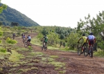
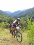
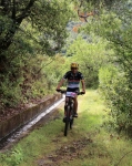
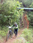
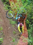
Two visitors to Oaxaca from the U.S. — David from Pennsylvania and Jeff from California — were in town and eager to sample the excellent trails in these parts. They hooked up with some Norte Americano mountain bikers who call Oaxaca home and who were happy to act as local guides. As the weather had been hot in the Valles Centrales in recent weeks, a ride in the high country seemed in order. So it was that five gringos set out this Tuesday, 19 April, to ride the El Carrizal Loop, described elsewhere on the “Rides” page of this web site.

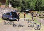
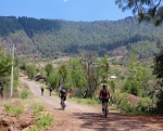
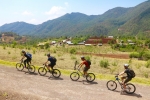
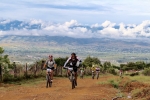
We stopped at the ecotourism office in San Miguel del Valle to register and pay the 50 pesos per person admission fee to use communal lands. We did not hire a guide, as we planned to ride well marked roads rather than footpaths through the woods. Then began the long, sinuous ascent to El Carrizal. We parked our van at the trucha restaurant below El Carrizal, geared up and began the climb into the village and then on up the mountainside, following the logging road that wends through La Neveria and La Ventosa, eventually reconnecting with the road from San Miguel. Recent overnight rains left puddles along the route, but the trail tread was in excellent condition, with a minimum of mud. It took almost exactly four hours to make the circuit, with time out for a sack lunch along the way. The group logged 12.2 miles (19.6 kms) on the loop, with an elevation gain and loss of 2219 feet (676 meters). The municipal building at El Carrizal sits at an elevation of 8951 feet (2728 meters). The highest point on the route was 10,213 feet (3113 meters). A creek crossing just outside San Miguel was the low point at an altitude of 5972 feet (1820 meters).

Three of our party elected to ride down the mountain to San Miguel del Valle, rather than returning to the van parked at El Carrizal. This deviation added 8.3 miles (13.3 kms) of downhill fun to the day’s adventure, with the guys dropping an additional 3983 feet (1214 meters) on the descent.


Llano Grande in the Rain

It was bright and sunny when 29 members of the “Nitos Ciclistas en Movimiento” bike club set out from Oaxaca at 7:15 am for a day ride at Llano Grande on Sunday, 25 October 2015. A caravan of ten cars and trucks hauled the riders, family members and their equipment the 42.2 mile (67.9 km) into the Sierra Madre. Unfortunately, heavy cloud cover rolled across the mountains and light rain began falling mid-way through the ride. The fog and rain prevented the group savoring the vista from the mirador, but made the forest vegetation seem more lush. Temperatures were mild, so everyone seemed to enjoy the outing, despite getting quite wet and muddy. The mud made for slow going; and tree roots and wooden bridges were especially slippery and dangerous. However, everyone made it safely through the ride and then enjoyed a hot lunch at one of the comedores in town before the group returned to Oaxaca.

Guides from the ecotourism camp at Llano Grande lead the way on a double loop through the dense woods. The route covered 9.95 miles (16.0 km), with an elevation gain and loss of 1812 feet (552 meters) for the day. Llano Grande sits at an altitude of 10,143 feet (3091.5 meters). The mirador was the highest point of the day, at 10,941 feet (3334.8 meters), while the cascada was the lowest point at 9635 feet (2936.7 meters).


“La Carroñera”

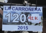
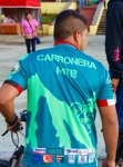
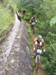
“La Carroñera” (“The Scavenger”) is an epic race held in the mountains just outside San Agustin Etla, a community a short distance to the north of Oaxaca city. On this particular day the contest drew a whopping 190 registered participants, all eager to test their mettle on this rigorous course, which ran 23.54 miles (37.88 km), using a combination of city streets, dirt roads, single track trails across the flanks of the mountain — and one section of tenuous trail running along the aqueduct that supplies water to San Agustin. There were three significant climbs along the way, the first being by far the longest and toughest, requiring contestants to use pedal power to gain 3711 feet (1131 meters) in altitude along the 7.2 mile (11.6 km) route from town to the highest point on the circuit — which topped out at an altitude of 9220 feet (2810 meters). The total elevation gain and loss riding around the course came to a whopping 6676 feet (2035 meters) — certainly a good day’s workout!

Those who preferred a somewhat less challenging course had the option of skipping the upper loop shown on the map. This reduced the overall length of the ride by 5.6 miles (9.0 km) and lopped off 2386 feet (722 meters) from the total elevation gain & loss for the day. Even so, the shorter ride totaled 17.9 miles (28.8 km) and demanded 4290 feet (1307 meters) of climbing and descending. Congratulations to all who completed the ride and earned a special medallion for their effort!


San Agustin Etla – Aqueduct & Hydroelectric Plant

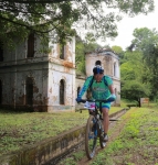
San Agustin Etla is a charming small village set in the foothills northwest of Oaxaca. Among its attractions are an aqueduct which brings water down the mountain from a small diversion dam to the municipal water treatment and bottling plant. It is also home to the Centro de las Artes – a splendid building which once housed a steam-powered textile mill, and has been converted to a gallery which displays traveling exhibits of art from Mexico and Central America. Be forewarned that there is some serious climbing to be done on this route, both on city streets, dirt roads and single track trails. This ride basically follows the first part of the 26 mile (42 km) course used for the famed “La Carroñera” bike race held at San Agustin from time to time.

The route shown on the map below covers 8.9 miles (14.3 km). The ride starts from the parking lot at the municipal building in San Agustin, which sits at an elevation of 5757 feet (1755 meters). The high point on the trail reaches an altitude of 7097 feet (2163 meters). The elevation gain and loss riding the trail amounts to 2034 feet (620 meters).

Single-tracking around La Cumbre

This Sunday (20 September 2015) the Summit Cyclery shop ride ventured into the high country around La Cumbre to sample two super single track trails. An assortment of trucks, vans and cars shuttled riders into the mountains and returned them safely to Oaxaca afterwards. The first part of the outing entailed entering the forest preserve at La Cumbre and riding the “El Cerezo” trail, a super downhill trail to El Punto. This trail has been upgraded recently, and a couple of jumps added to heighten the fun! Kudos to the crew that did the work! The El Cerezeo trail ran 3.45 miles (5.55 km), almost entirely downhill, losing 1730 feet (527 meters) in altitude. (First of the two maps, below.)

Once in El Punto, the group shuttled back up the highway and down a side road to the start of the 204 Trail. This, too, was a sizzling downhill run, made more adventurous by the mud on the trail and the moss on the rocks. Even new tires with stout knobbies were prone to slide around in the goo! Several riders took tumbles along the way, but everyone survived to tell their tale. This second trail of the day’s outing ran 5.3 miles (8.5 km), losing 2711 feet (826 meters) in elevation along the way. (Second of the two maps, below.)


Invalid Displayed Gallery