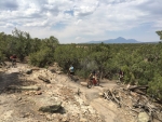
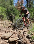
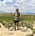
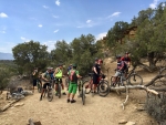
The Mil Rios ride is a true classic. The Mil Rios trail can be ridden in and of itself, using a shuttle to reach the trailhead not far from the village of La Neveria. It can also be tackled as part of a long and demanding loop ride passing through Teotitlan del Valle and Benito Juárez to get to the trailhead – as shown in the map below. Riders will struggle to climb 4778 feet (1456 meters), but get to cruise down 4586 feet (1398 meters) on the way home. Caution: the Mil Rios trail is steep and rocky in many places, so good bike handling skills are necessary.
Category: Mountains
Countryside, GPS, Mountains, MTBing, Ride Routes, Trail Info
Monster Rides
by Larry • • 4 Comments
The members of the Pedalazos bike club have embarked on a couple of monster rides on recent Saturday mornings. These epic excursions took most of the day and entailed huge climbs and descents, challenging even the toughest of riders.
The first of these was a grand loop covering 48.5 miles (78.0 kms) from Oaxaca city through the small mountain hamlet of Arroyo Guacamaya, then continuing up and through the Sierra Norte mountains on logging roads to the ecotourism camp at La Cumbre Ixtepeji and then down the La Reina trail into Huayapam, concluding in Oaxaca about nine hours later. The outing began near downtown Oaxaca at an elevation of 5124 feet and topped out at a high point of 10,398 feet (3169 meters). Those who survived the ride managed to pedal uphill 7008 vertical feet (2136 meters), to be rewarded with 7073 feet 2156 meters) of vertical drop coming down off the mountain. Talk about an endurance contest! Kudos to all those stout – or foolish – enough to take on the challenge! Here is a map of the day’s route:
Several weeks later stalwart riders in the club set out on a similar epic ride, this time pedaling east of the city to the famed weaving town of Teotitlan del Valle, then tackling the unpaved road that winds eleven miles steeply uphill to the village of Benito Juárez. From there the group proceeded 10 kilometers to La Neveria and then dropped down the loose and steep Mil Rios trail, which comes off the mountain near the town of Tlalixtac. Start to finish, the circuit ride covered 45.3 miles (72.9 kms), with over 6250 feet (1905 meters) of vertical gain and loss. The excursion took 9 hours and 40 minutes to complete. Again, congratulations to those who persevered to the end, despite some serious crashes on the treacherous downhill Mil Rios trail! Below is a map showing the route taken:
GPS, Mountains, MTBing, Photos
Colorado Country
by Larry • • 0 Comments
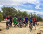
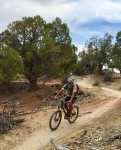
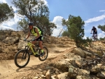
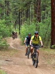
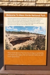
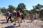
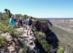
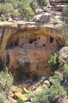
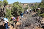
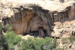
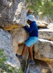
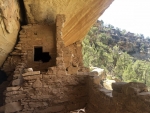
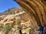
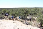
The “Rocky Mountain Bicycle Boys” is a fun-loving mountain bike club located in Denver, Colorado. For over 25 years the group has sponsored annual multi-day trips to favorite places around Colorado over the Independence Day holiday centered around the 4th of July. For the summer of 2018 the club rented a spacious vacation home near Durango, Colorado to be the headquarters for several rides and a day of hiking among the ancient Indian ruins near Mesa Verde National Park. Fellows from as far away as Kansas and California – and two from Oaxaca – took part in the adventure. A raging forest fire north of Durango that began on 1 June threatened to disrupt the annual trip, as highways, local trails and even the San Juan National Forest were closed at times due to the wildfire. Happily, though, the trip took place as planned. The heavy smoke that saturated the hills for many days had dissipated by the time club members arrived on 3 July and we had excellent weather for mountain biking. The fire actually worked in our favor, as there were not nearly as many summer tourists crowding the bars and restaurants in the area, and we pretty much had the hiking and biking trails to ourselves. The first day’s mountain bike adventure took place on the excellent trail network of “Phil’s World” just outside Mancos, Colorado. The second day’s ride took advantage of the complex of loop trails in Boggy Draw, a few miles from the town of Dolores, Colorado. Blue skies and mild temperatures offered ideal conditions for our rides, and a great time was had by all.
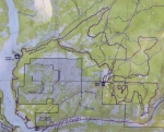
Trail map of Phil’s World near Mancos, Colorado.
Trail map of Boggy Draw near Dolores, Colorado.
GPS, Mountains, MTBing, Photos
Nexicho to Zoquiápam
by Larry • • 1 Comment
Three expats living in Oaxaca set out on this bright Thursday morning in late March to explore some new territory in the Sierra Norte mountains to the north of Oaxaca city. Using a minivan to haul themselves and their bikes into the high country, the trio drove north on Hwy 175 through La Cumbre to El Punto, then took a newly-paved country road to San Pedro Nexicho where they unloaded the bikes, got in the saddle and rode to San Matias Zoquiápam and back, covering just under thirteen miles (21 kms) along the way. Although the total elevation gain and loss was about 2000 feet (609 meters), the logging roads used were never particularly steep so the pedaling was easy. It was a warm March day in the Valles Centrales, but the temperature in the mountains was perfect for such an outing. Alex, Andy and Larry spent three hours on their out-and-back ride, taking time along the way to stop for refreshments at a trout farm and restaurant tucked into the hillside along the way. An excellent time was had by all.
GPS, Mountains, MTBing, Photos
Gringos Go For An Epic Ride
by Larry • • 0 Comments
With the coming of December there are enough gringo mountain bikers in winter residence in Oaxaca to constitute a weekday riding group. On this first day of December five guys set out from Oaxaca to ride an epic loop in the mountains. The plan was to ride in the Sierra Norte from La Cumbre to La Neveria and then plunge down the mountainside on the Mil Rios trail (14% grade in many places) into Tlalixtac. The total distance for the day’s outing amounted to 45.9 miles (73.8 kms) and had a total elevation gain & loss of 6518 feet (1987 meters). The group pedaled to the monumento on the east side of town, where they hired a camioneta to haul themselves and their gear up Hwy 175 to La Cumbre. This mechanical assist eliminated pedaling 13 miles (21 kms) and saved the group climbing 3875 feet (1181 meters) up the mountainside. But that still left a challenging 32.9 miles (52.9 kms) for the gringos to manage under their own power.
The portion of the ride between La Cumbre and (almost to) La Neveria entailed riding 12.3 miles (19.8 kms) on logging roads — which, as it happened, had several crews cutting trees in the forest and hauling the logs out on nearly a dozen trucks. Our bikers managed to climb 2075 feet (632 meters) and descend 1918 feet (584 meters) on this segment of the ride.
The most challenging part of the ride — and the most fun — was the descent on the Mil Rios trail. It was also the most confusing. Even though one fellow in our group had ridden this way before and we had a fairly accurate GPS map of the trail, we still managed to make a couple of wrong turns. For a while it was a comedy of errors — think “Laurel and Hardy meet the Three Stooges”. At one point we spent 45 minutes bushwhacking up and over a ridge in the hope of connecting with the correct trail. Happily, we were successful in this endeavor. And once on the Mil Rios trail, it was all downhill. A good part of the trail was great fun, as we swooped merrily through the woods. But there were also many really steep and rocky sections that had some of our riders hike-a-biking. We found the Mil Rios trail ran 9 miles (14.5 kms), dropping 3768 feet (1148 meters) in altitude to the town of Tlalixtac on the floor of the Tlacolua Valley. From there the final 7.9 miles (12.7 kms) was an easy ride back to Oaxaca.
