Category: Mountains

Llano Grande

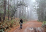
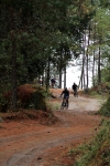
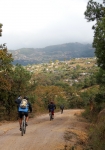
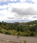
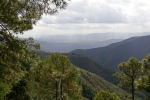
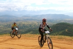
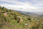
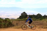
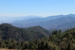
The ride from Benito Juarez through Cuajimoloyas to Llano Grande is one of the easiest treks in the Pueblos Mancomunados, as it takes place mainly on a paved road and has relatively little elevation change along the way — at least compared to other rides in the Sierra Norte mountains. Given the altitude of nearly 10,000 feet (3048 meters), you’re riding on top of the world. You will often see clouds in the forest below you as you swoop along this wonderfully scenic route.

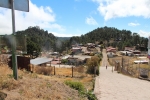
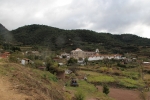
While all three of these very small villages are quite charming, Llano Grande is the most unique, with an architectural style and flavor that made me feel like I had stumbled into an elfin enclave in Bavaria or been somehow transported to the world of Hobbits. Each town has an ecotourism center where you can get information, hire trail guides or rent cozy cabins for overnight stays.

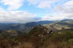
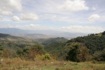
If you do the out-and-back ride, sticking to the road both ways, it will take you 20.5 miles (33.0 km) through gently rolling terrain, sometimes in dense forest and at other moments presenting panoramic vistas. The overall elevation gain & loss riding back and forth is 2330 feet (710 meters). There are no demands for technical bike-handling skills on this trip. However, the altitude may present some physical challenges to those who venture here from sea-level locations.

The map below, however, includes a section of excellent fire road that plunges down, up and around through the woods between Llano Grande and Cuajimoloyas. It is a delightful addition to the simple out-and-back ride on the main road. Including this lollipop loop will boost your total mileage to 23.6 miles (38.0 km). Along the way you will climb 3015 feet (919 meters) and drop 2949 feet (899 meters). A word of caution, though. There are lots of unmarked intersecting logging roads in the area. Exercise caution so that you don’t get lost or wind up far from your intended destination! Give yourself plenty of time and carry lots of water.

La Cumbre

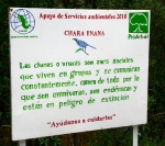
The World Wildlife Fund sponsors a forest preserve in the Sierra Norte mountains immediately north of Oaxaca. The preserve is sizeable, extending 15 miles (24 km) from La Cumbre to Santa Catarina Ixtepejic. The area is criss-crossed with old logging trails that are now closed to vehicular traffic, but are terrific for hiking and mountain biking. There is a fee of 50 pesos to gain entrance to the reserve, and guides are available, if desired.

This particular out-and-back ride goes a total of 19.8 miles (32 km) from the entrance station on highway 175 on one of the many interconnecting trails in the woods. The elevation gain going in and coming back out comes to 3742 feet (1140 meters). And don’t forget that you are operating at an altitude of about 9000 feet (274 meters), to begin with. This ride is rated “Moderate.”

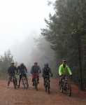
There are no grand vistas or archeological ruins to be had here. Just the peace and tranquility to be found in the deep forest. Be aware that the temperature in the cloud forest is usually about 20 degrees Fahrenheit (6.6 degrees Celsius) lower than conditions in Oaxaca. Morning fog and drizzle is commonplace, even in the dry season, so dress accordingly.

San Pablo Cuatro Venados

If you are in the mood for a killer climb, then this ride from San Felipe (or Oaxaca) to San Pablo Cuatro Venados will surely put a smile on your face. It will also certainly sear your lungs and burn your legs!

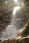
Cuatro Venados sits high atop the ridge of the mountains that form the western rim of the Etla Valley, one of three of the Valles Centrales around Oaxaca city. There are stunning views from the sinuous dirt road that winds up from the valley floor. There is also an impressive waterfall in the ecotourism park a couple of miles beyond the village (where this particular ride ends).

This out and back ride clocks in at 48.5 miles (78 km) with an elevation gain of 6326 feet (1928 meters) for the round trip. Yikes! Better eat your Wheaties before you set out! The ride is rated “Difficult” because of the length, altitude and steepness of the grade. There are no technical sections to navigate, however, as the entire route is on paved or unpaved roads.

For another variation on a ride focusing on this area, see “Cuatro Venados Loop” ride on this page, above.

Oaxaca to Benito Juárez & Back

One Sunday I decided to ride from my home in San Felipe del Agua (a suburb on the north side of Oaxaca city) to the village of Benito Juarez, part of the Pueblos Mancomunados in the Sierra Norte, approximately thirty miles east and a bit north of Oaxaca. I had driven the dirt road between Teotitlan del Valle to Benito Juarez a number of times, and had ridden the screamer descent (a 5000 foot drop in 11 miles) on my mountain bike a couple of times. However, I’d never been crazy enough to crank up that mountain — until this day.

I took my time, and so the round trip took nearly nine hours, covering 65.3 miles (105 km) and required climbing 6140 feet (1871 meters) along the way. Needless to say, my legs felt like rubber and I was one tired biker by the end of the day. I accomplished the outing using some city streets, but for the most part stuck to bike paths, dirt roads and a few short sections of cowpaths. I never rode on the highway, though that was an option, as the highway between Oaxaca and Mitla is freshly paved and has wide shoulders. (Caution: it is the custom in Mexico for slow vehicles to drive on the shoulder of a highway to permit faster cars to pass, so even a wide shoulder can be a dangerous place for a bicycle.) 

If you elect to do this ride, but use the Zocalo instead of San Felipe as the start / end point, the distance will be 7 miles shorter and the elevation gain / loss will be 750 feet less.


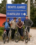
Latuvi / Benito Juarez / La Neveria Loop Ride

This is a lovely loop ride between three communities in the Pueblos Mancomunados, mostly on dirt roads but with some rough singletrack on steep hillsides in the forest mid-way between La Neveria & Latuvi. Most of the ride is at elevations between 9,000 and 9,500 ft (2745 – 2895 meters). The total distance is 19.6 miles (31.5 km). There is 3663 feet (1116.5 meters) of climbing along the way — but that includes a visit to the scenic overlook (“mirador”) above Benito Juarez (which is well worth the stop, by the way).

It took our group nearly six hours to complete the ride, but that was because we had some slow riders, stopped at the Mirador, and then had dinner in Benito Juarez. Experienced riders can probably knock out the loop in about half that time. Incidentally, we started and finished the loop in Latuvi because that put the biggest climb at the beginning of the ride. However, most people would likely prefer to begin at Benito Juarez, the town closest to Oaxaca city. We rode the loop clockwise, and think that is the best way; but it can also be done in the opposite direction.

Visitors to the Pueblos Mancomunados should be aware that the temperature in the high country is usually about 20 degrees Fahrenheit (6.6 degrees Celsius) cooler than in Oaxaca, and that morning fog and drizzle are commonplace, even in the dry season. For that reason, a light jacket and/or rain gear is recommended. Also, native guides are available to take visitors between villages on either hiking or biking trails, and may be hired for about 200 pesos for the day.