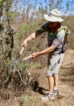
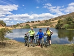
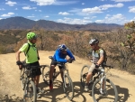
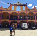
Late last October a small group of friends went for a hike on the trails in the foothills above the village of San Pablo Etla. Their objective was to follow the same loop trail used for a mountain bike race held there annually. To their dismay, they found the vegetation so thick at the end of the rainy season that in places they could not even find the trail! So on this Saturday in mid-March several fellows set out with machetes, hedge clippers, pruning shears and tree saws to clear away the brush from the trail. They were in for a couple of pleasant surprises. First of all, after five months without rain all the greenery was gone. The trees and shrubs were bare of leaves, which made it much easier to prune back branches that hung out over the trail. And secondly, it was obvious another work crew had passed this way in recent weeks, as much of the vegetation had already been cut back. So what was expected to be a hard day of heavy work turned out to be much easier and faster than anticipated. Now hikers and mountain bikers will be able to pass freely on the network of intersecting trails that criss-cross the hillsides near San Pablo. For more information on these, see the various entries under “San Pablo Etla” on the “Rides” page of this web site.
Category: Hiking
Countryside, GPS, Hiking, MTBing, Photos
Mapping the Route for a Hike
by Larry • • 0 Comments
Albi and Larry are both mountain bike enthusiasts and sponsors of a program of weekly hikes around the Valley of Oaxaca and in the surrounding mountains (see www.HoofingItInOaxaca.com). They are always interested in finding new places to take groups of hikers. Many of the hike venues utilized each year were first explored aboard mountain bikes. Such was the case for a proposed new hike from the town center of San Tomas Mazaltepec to San Felipe Tejelápam. The purpose of today’s ride was to map the hike route and find out from local officials what permissions and/or payments were needed before bringing van loads of gringo tourists to hike in this part of the Etla Valley north of the city of Oaxaca. The day’s excursion got under way at 10 am, allowing the sun to warm things up on a mid-winter day. Larry and Albi were joined by Ron and Rafa for the outing. Moving at a leisurely pace, the foursome covered 30.9 miles (49.7 kms) and gained and lost 1774 feet (541 meters) in elevation on what amounted to an out & back ride with a lolly-pop loop at the far end. It was along that loop that the hike route was mapped out. It turns out the new hike will run 5.7 miles (9.2 kms). The highest point along the route tops out at 6097 feet (1858 meters), with the lowest part registering 5418 feet (1651 meters). Hike participants will climb 682 feet (208 meters) and descend 731 feet (223 meters) in the course of their walk.
Countryside, GPS, Hiking, MTBing, Photos
Turning Bike Trails into Hiking Trails
by Larry • • 1 Comment
Oaxaca attracts hordes of winter visitors from Canada and the U.S. each year, many of whom enjoy hiking in the Valles Centrales and the mountains nearby. Now the director of the “Hoofing It In Oaxaca” hiking program is an avid mountain biker, who also happens to be an administrator of this web site. And so it is no surprise that many of the trails used by gringo hikers November thru March are the same trails enjoyed by local mountain bikers year ’round. The hike coordinators are always looking for new trails to add to the dozens of venues presently in use. And so it was that Albi and Larry went scouting on their mountain bikes in the Etla Valley recently, hoping to find a route that would work equally well for a group of hikers. And they succeeded!
The rolling hill country on the west side of the Etla Valley is very scenic and a delight to both hikers and mountain bikers. It is a beautiful area at any time of the year. Larry and Albi pedaled a loop linking San Andrés Ixtlahuaca and San Felipe Tejalápam. The map below shows the route they followed. The trail on the left runs 5.3 miles (8.5 kms) from San Andrés (at the bottom of the loop) to San Felipe (at the top) and offers some great views of the surrounding countryside. The trail on the right is an alternate route which is somewhat shorter (4.2 miles / 6.7 kms) and with a little less elevation gain and loss (a bit over 400 feet / 122 meters). After riding and mapping the route, a group of hikers was mustered to try it out. All agreed it was a great hike.
For more information about the hiking program, visit www.HoofingItInOaxaca.com.
Countryside, Hiking, Mountains, MTBing, Trail Info
San Agustin Etla – Aqueduct & Hydroelectric Plant
by Larry • • 0 Comments
San Agustin Etla is a charming small village set in the foothills northwest of Oaxaca. Among its attractions are an aqueduct which brings water down the mountain from a small diversion dam to the municipal water treatment and bottling plant. It is also home to the Centro de las Artes – a splendid building which once housed a steam-powered textile mill, and has been converted to a gallery which displays traveling exhibits of art from Mexico and Central America. Be forewarned that there is some serious climbing to be done on this route, both on city streets, dirt roads and single track trails. This ride basically follows the first part of the 26 mile (42 km) course used for the famed “La Carroñera” bike race held at San Agustin from time to time.
The route shown on the map below covers 8.9 miles (14.3 km). The ride starts from the parking lot at the municipal building in San Agustin, which sits at an elevation of 5757 feet (1755 meters). The high point on the trail reaches an altitude of 7097 feet (2163 meters). The elevation gain and loss riding the trail amounts to 2034 feet (620 meters).
Hiking, Mountains, MTBing, Trail Work
Trail Work and Other Improvements at La Cumbre
by Larry • • 0 Comments
The crew that manages the ecotourism camp at La Cumbre, in the mountains just off Hwy 175 a few miles north of Oaxaca city, have been busy making improvements this summer of 2015. They did some serious trail work to grade and widen the single track portion of the route used for annual mountain bike races there. And there is a new observation tower atop the Mirador that offers a stunning view of the surrounding countryside. These improvements follow the construction of a new kitchen and dining room two years ago. Kudos to those responsible for this work!
