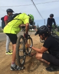
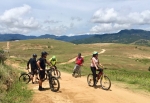
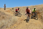
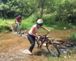
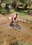
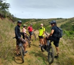
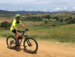
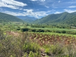
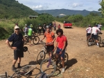
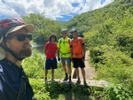
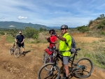
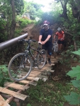
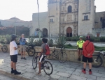
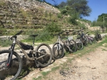
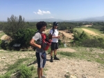
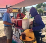
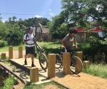
Five amigos set out this Sunday morning from central Oaxaca for a ride through the countryside to Lobera and back. This was in no way a groudbreaking ride, as it is a favorite route for people wanting to pedal into the Zimatlan valley south of Oaxaca. It was, however, the first time two members of the pack had ridden this way. The group spent nearly an hour pedaling to Zaachila, where they stopped at the mercado gastronomico for refreshing glasses of fresh-squeezed fruit juices. Then it was on to Lobera, following the paved road that leads through Lobera, on up to Santa Ines de Monte and eventually to San Miguel Peras deep in a secluded mountain valley. There were lots of other cyclists cruising this same road. The ride would have been uneventful but for the fact one member crashed hard while streaking downhill on a curve just after departing Lobera. Fortunately, he escaped with few scrapes and bruises, but suffered a moderate concussion that left him with no recollection of the accident. Hey, some things are best forgotten anyway! The round-trip distance traveled amounted to 31.2 miles (50.2 km), with an elevation gain and loss of 1088 feet (332 meters). Elapsed time in the saddle amounted to a bit over four hours.
Category: GPS
Countryside, GPS, MTBing, Photos
West Etla Valley Loop Ride
by Larry • • 0 Comments
Over time certain mountain bike rides occur again and again, eventually earning status as favorite outings. So it is with this loop ride through the rolling hill country to the west of Monte Alban. The loop can be ridden just as well clockwise or in the opposite direction. Going clockwise, it is an 8.5 mile (13.7 km) ride on paved roads from central Oaxaca to Cuilapam, then an excursion on farm roads 8.35 miles (13.4 km) through the countryside until reaching the highway running between the archeological ruins of Monte Alban and Atzompa. From there the route is paved for the ride back to the capital. Though covering a distance of 23.3 miles (37.5 km), this outing is rated moderate, as there are no technical sections and just a couple of short, steep uphill climbs to challenge the cyclist. Overall, it is a nice mix of urban and country scenery.
<
Countryside, GPS, MTBing, Photos
Mid-summer Ride
by Larry • • 0 Comments
It is Sunday, the twelfth day of July – midway through the summer of 2020. Mexico is still in the grip of the coronavirus crisis, with thousands of new cases of Covid-19 being reported every day. But it has been four full months since restrictive measures were put in place to slow the spread of the pandemic, and people are weary of staying home and desperate to get back to work. So now many stores and restaurants are reopening and lots of street vendors have once again set up stands to sell their merchandise. People are walking a tightrope, torn between social distancing and getting the economy back in gear. Through these past several precarious months the ability to go mountain biking each week has been a lifeline, a welcome antidote to pandemic funk.
Four bikers showed up for today’s group ride. Two of them are new to the area and had never ridden to Santo Domingo Tomaltepec and the two presas not far up a nearby mountain valley. So that was voted the day’s destination. Ours was not the only group pedaling around the countryside on this bright, sunny morning. We encountered lots of other cyclists along the way, some riding alone but most in groups of from four to eight bikers. There were also several family groups hiking along country roads. We moved at a leisurely pace, taking almost six hours to cover the round-trip distance of almost 24 miles (38.6 kms), counting a lunch stop at the market in Tlalixtac on the way back to Oaxaca.
Countryside, GPS, MTBing, Photos
Ride to San José El Mogote
by Larry • • 0 Comments
One of the oldest but least known archeological sites near Oaxaca is the temple mound at San José el Mogote, It is thought that at one time Mogote was the largest and most influential settlement in the Valles Centrales and was likely the center of political and economic power of the earliest Zapotec kingdom, from which Monte Alban sprang. There is a small but interesting museum adjacent to the temple ruins. These made a fine destination for an easy bike ride for a half-dozen riders on the second day of July in 2020. With the coranavirus pandemic still in full swing, this outing was a welcome escape from the confines of the city and a chance to stretch one’s legs and lungs in the open countryside. The round-trip distance amounted to 24.2 miles (39 kms) over relatively flat terrain where the elevation gain and loss amounted to a mere 190 feet (58 meters). Bikers finished the outing in three hours, riding at a leisurely pace.
For more information about the history of San José el Mogote, go to: https://en.wikipedia.org/wiki/San_Jos%C3%A9_Mogote
Countryside, GPS, MTBing, Photos
Welcome to Oaxaca Ride
by Larry • • 0 Comments
Robert recently moved to Oaxaca from Baja California and has been anxious to meet and ride with fellow expat mountain bikers who call Oaxaca their home. This last day of June was chosen to make it happen. Larry, Ron, Alex and Tom set out at 9 am and rode the bike path to Tule, where Robert was waiting for them. After introductions were complete, the group pedaled on to Santo Domingo Tomaltepec and then Tlalixtac, where all were eager to ride the Los Molinos trail. It was a beautiful morning for a bike ride through the countryside. The air was fresh after a heavy thundershower the night before. Farm fields in the valley and wooded mountain slopes were verdant with spring growth. The total distance traveled amounted to 27.4 miles (44.1 kms), with an elevation gain and loss of 1280 feet (390 meters) on the circuit. Everyone expressed satisfaction with the day’s outing.
