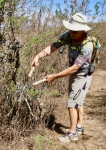
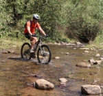
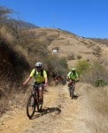
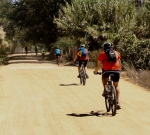
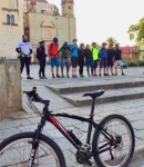
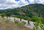
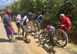
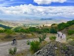
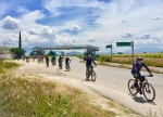
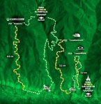
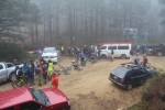
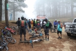
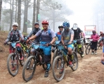
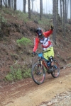
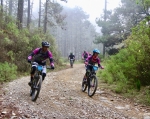
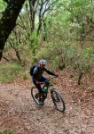
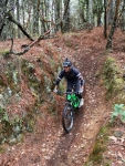
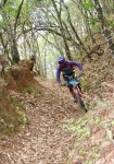
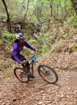
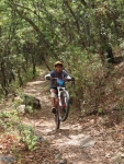
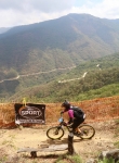
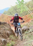
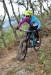
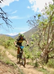
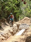
Late last October a small group of friends went for a hike on the trails in the foothills above the village of San Pablo Etla. Their objective was to follow the same loop trail used for a mountain bike race held there annually. To their dismay, they found the vegetation so thick at the end of the rainy season that in places they could not even find the trail! So on this Saturday in mid-March several fellows set out with machetes, hedge clippers, pruning shears and tree saws to clear away the brush from the trail. They were in for a couple of pleasant surprises. First of all, after five months without rain all the greenery was gone. The trees and shrubs were bare of leaves, which made it much easier to prune back branches that hung out over the trail. And secondly, it was obvious another work crew had passed this way in recent weeks, as much of the vegetation had already been cut back. So what was expected to be a hard day of heavy work turned out to be much easier and faster than anticipated. Now hikers and mountain bikers will be able to pass freely on the network of intersecting trails that criss-cross the hillsides near San Pablo. For more information on these, see the various entries under “San Pablo Etla” on the “Rides” page of this web site.
Category: Foothills
Countryside, Foothills, GPS, MTBing, Photos
Oaxaca – W. Etla Valley – Cuilapam
by Larry • • 1 Comment
The rolling hill country of the Etla Valley to the west of Monte Alban is a lure to mountain bikers wanting to escape from the city. Riding from Oaxaca to Cuilapam provides a perfect getaway, offering pleasant vistas to soothe the soul and just enough challenging terrain to rate as a good day in the saddle. The out & back route from the center of Oaxaca to the ruins of the never-completed monastery in Cuilapam covers 31.4 miles (50.5 kms) and accumulates 2625 feet (800 meters) of elevation gain and loss along the way. It is also possible to ride a loop through Cuilapam that returns to Oaxaca via the main paved highway, which is shorter and faster (see second map below) — covering just 23.6 miles (37.5 kms) and with only 1505 feet (459 meters) of climbing and descending. Either option makes for a great cycling experience.
Countryside, Foothills, MTBing
Buddy Ride
by Larry • • 0 Comments
Another delightful, sunny, warm Sunday morning in Oaxaca – even though it is December 2 on the calendar. Four buddies agree to go on a loop ride through the rolling hill country of the Etla Valley to the west of Monte Alban. Two – Albi and Larry – are retired gringo expats living in Oaxaca, while Omar and Vidal are natives. The foursome rendezvous at the Plaza Bella shopping center in Atzompa at 9:30 am – late enough in the day for the sun to take the chill out of the air and for everyone to have breakfast before the ride. After a brief discussion they agree to ride in a counter-clockwise direction, first pedaling north toward San Lorenzo Cacaotepec, then swinging west to San Felipe Tejalápam, through La Unión and then on to Jalapa del Valle. After a brief rest stop, they head east over a ridge of hills, drop down and through San Pedro Ixtlahuaca and on into the Oaxaca valley and their original starting point. By the end of the ride the guys have been in the saddle a bit under three hours and have covered exactly 22 miles (35.4 kms). There was a gain and loss of 550 feet (167.6 meters) along the way, mainly due to crossing that ridge. The temperature ranged from 60 to 75 degrees Fahrenheit (16 to 24 degrees Celsius) during that time.
Countryside, Foothills, GPS, MTBing, Photos, Trail Info
Sunday 70 Kilometer Loop Ride Around Oaxaca
by Larry • • 0 Comments
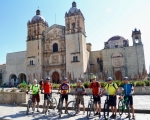
Recent visitors to this web page, whether regular clients or first-timers, might well wonder about the state of mountain biking in Oaxaca or the health of the web site, given the relatively few new posts put online over the past several months. Well, be assured that both are alive and well. As the years go by local mountain bikers necessarily repeat their favorite rides over and over, as there is less and less new territory to be explored. So while local bike clubs continue to sponsor weekly outings, there is not much incentive to post stories which basically repeat what has already been presented. This post is a case in point. A group of 24 mountain bikers assembled on Sunday morning in front of the church of Santo Domingo on the Macedonia Alcala (pedestrian mall in downtown Oaxaca) eager to set out on a 70 kilometer (43.1 mile) loop ride through the Tlacolula and Zimatlan valleys near the capital city. It would be a challenging and satisfying ride, but would follow a route well known to the riders. First following the paved bike path to Tule, the route would then use country roads through Rojas de Cuauhtemoc, Santa Rosa Buena Vista, San Juan Teitipac, Santa Cecilia Jalieza, Santo Domingo Jalieza and San Pedro Guegorexe before catching Highway 175 running north through San Bartolo and Santa Maria Coyotepec back into Oaxaca. The group was reminded along the way that civilization was encroaching on the countryside, as much of the seventy kilometers that was dirt road ten years ago now features pavement, not only in the various villages but on many of the connecting roads. That made the going easier — a fact appreciated by the riders who were now ten years older than in those bygone days. In summary, the group gained and lost a total of 875 meters (2870 feet) in elevation riding the loop. The high point was 1800 meters (5907 feet) crossing the ridge of hills separating the Tlacolula and Zimatlan valleys. The low point was 1517 meters (4977 feet). The group made a wrong turn passing through San Juan Teitipac, which resulted in following a farm road that eventually disappeared into plowed fields, necessitating some bushwhacking to return to the proper road. This, in turn, contributed to there being at least six flat tires among the riders, which accounted for the slow pace of the group. Still, it was a lovely day to be out on a bike and everyone had an enjoyable time.
Foothills, GPS, MTBing, Photos, Racing, Ride Routes
Enduro MTB Race
by Larry • • 0 Comments
The third round of the 2018 National Intense Enduro series took place in the mountains not far from Oaxaca city on Saturday, 5 May 2018. The race was held in three stages, using some of the nearby trails popular with local riders. The first stage utilized the Veredita trail, which begins at the summit of a logging road 3.2 miles (5.1 kms) above the village of Guacamaya 23 miles (37 kms) north of Oaxaca city in the Sierra Norte range. With the starting gate at an altitude of 9051 feet (2758 meters), this was the highest point of the race circuit. This trail runs downhill 8.6 miles (13.8 kms), ending near the town of San Miguel Etla, a descent of 4998 feet (1523 meters). From that point, race contestants had to either shuttle or pedal back up the mountain to the ecotourism camp of Cieneguillas, where they then rode the single track Cieneguillas trail 3.9 miles (5.2 kms) down to San Agustin Etla, losing 2240 feet (683 meters) along the way. Then it was back up the mountainside to catch a short portion of the Carroñera race course trail, which drops 2.0 miles (3.2 kms) back to San Agustin, generally following the aqueduct that carries water into the village. This last section was the mildest, dropping just 863 feet (263 meters). The race concluded at the Casa de las Artes in San Agustin, a very impressive structure that once housed a large textile mill, now converted into a center which displays traveling exhibits of art from Mexico and other countries of Central America.
Map of the Veredita trail:
Map of the Cieneguillas trail:
Map of San Agustin Etla Aqueduct trail:
