Category: Foothills

Viguera Loop Ride

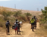
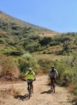
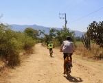
Today’s Sunday ride was a moderate one for both time and distance but the route offered some challenges because of the steep and rocky terrain covered. Our group of six riders left from Santo Domingo, heading north up the hill through San Felipe del Agua. Rather than sticking to pavement, riders churned up some gnarly back roads to reach the Libramiento Norte, which they then followed to the top of the mountain ridge and then zoomed full speed down into Viguera. At that point the pack split in half, with three riders continuing on to San Pablo Etla while the other three dropped down to the old railroad line which they then followed back to Oaxaca. This shorter route is the one shown on the map, below. The bikers going this way put 31.5 kilometers (19.6 miles) on their odometers while accumulating 411 meters (1349 feet) of elevation gain and loss on the ride.

Ride to San Pablo Etla

It is late April in Oaxaca and another perfect day in paradise. Our Sunday ride this week took us from el centro up the hill to San Felipe del Agua, then over the Libramiento Norte to Viguera and on into San Pablo Etla. After a light lunch at a local comedor we rode on to Santa Cruz Etla and then back into Oaxaca along the old railroad right-of-way. This was a moderate ride overall, with just a bit of technical challenge on the rough and tumble singletrack trail we used to get from the top of the Libramiento down into Viguera. The outing covered 25.1 miles (40.1 kms) and entailed climbing about 1920 vertical feet (588 meters). The high point on the ride was an elevation of 6210 feet (1893 meters). Counting time for lunch, the day’s excursion took just a hair more than five hours.

Another Grand Loop Ride

        It is mid-November and the weather in Oaxaca continues to be ideal for mountain biking. The thermometer registered 54ºF / 12ºC at sunrise, with a forecast high of 81ºF / 27ºC for the day. The morning boasted clear blue skies, but clouds built up by mid-day, though with no threat of rain. A biker who is a relative newcomer to Oaxaca proposed riding a long and rather challenging loop south out of town through San Bartolo Coyotepec, then across a mountain ridge to San Sebastian Teitipac in the Tlacolula valley to the east. From there the way home would loop through Rojas de Cuauhtemoc and Tule. Four fellows met at the appointed place and began the ride at 9 am. It took an hour to pedal to San Bartolo, using mainly country roads. Then the climb began. The trail was a rough jeep road that ascends 925 vertical feet (282 meters) to a pass crossing the ridge of hills. The riders spent 1.5 hours getting from San Bartolo to San Sebastian Teitipac. From there it was an easy ride on mainly paved roads to Tule and thence back to Oaxaca on the bike path. While riding through San Sebastian our cyclists encountered ten members of the Chalinos bike club from Rojas de Cuauhtemoc who were also enjoying a Sunday ride. They were an impressive sight, as all wore matching uniforms. It was early afternoon by the time the group reached Tule, so it was decided to stop for lunch at a seafood restaurant there. Some cold beer and ceviche really hit the spot!                                                                                                                                       Here are the stats for the day’s outing.  Distance ridden: 35.9 miles / 57.8 kms.  Total elevation gain and loss on the circuit:  1524 feet / 464 meters. Low point on the loop:  4959 feet / 1511 meters.  Highest point: 5891 feet / 1796 meters.  Total elapsed time (including lunch break):  5.5 hours.  Rating:  difficult because of length of ride and roughness of uphill sections on jeep road.

Ride on the Los Molinos Trail

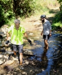
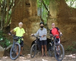
It is a good bet that some fellows will get together for a weekday ride every Tuesday morning. A flurry of emails usually precedes the outing as people are informed of the ride parameters and sign up for the excursion. Cyclists congregate in front of the church in San Felipe del Aqua at 8:45 am prior to a 9 o’clock departure. Most days the group rides the network of trails in the hills above San Felipe. This affords everyone an opportunity for some serious exercise but does not eat up too much time, as the ride is finished by 11:30 or 12:00 noon. On this particular Tuesday in early November, though, the riders opted for something different. Ron, Larry and Steve rode east on the hillside above San Luis Beltran and Donaji, first on the Libramiento Norte and then on a great single track trail that winds along the contours of the mountain and terminates in Huayapam. After stopping at a juice stand in the local mercado there for some liquid refreshment, they continued through town to the two presas, then pedaled on to the start of the Los Molinos trail in Tlalixtac. This lovely trail is a perennial favorite of hikers and mountain bikers alike. It was a glorious day for a ride in the countryside, with bright sunshine and a forecast high temperature of 84ºF / 29ºC. After posing for a photo at the ruins of the old water-powered grain mill, the three headed back to Oaxaca using a combination of country roads rather then returning on the foothills trail. Once arrived back in San Felipe they stopped for a tasty lunch at the Mónica Hindu restaurant. The day’s excursion covered 20.1 miles (32.3 kms) and encompassed an elevation gain and loss of 2101 feet (640 meters) along the way. The high point was 5802 feet (1768 meters) on the Libramiento above San Felipe. Time in the saddle amounted to 4 hours and 25 minutes.  The second map, below, shows just the Los Molinos trail itself.

Oaxaca – Rosario – Tule – Tomaltepec – Tlalixtac Loop

A couple of mountain bike visitors to Oaxaca were curious to ride two of our favorite trails in the Tlacolula valley – the “Back Way to Tule” and the ride to the presas in the hills above Santo Domingo Tomaltepec – so we combined them in one delightful loop ride.  Early spring rains had worked their magic on the countryside, so both farm fields and forested mountainsides were carpeted with bright green foliage. A group of five bikers set out at 9 am on a lovely Thursday morning for this very satisfying excursion. The trail to Tule takes off into the hills from the Rosario neighborhood on the far southeastern corner of Oaxaca city. Getting to the trailhead involves riding for 5.25 miles (8.4 kms) from el centro through a maze of city streets. Then the fun begins! The next 1.8 miles (2.9 kms) is on a rugged jeep road that rises rather steeply 455 vertical feet (139 meters) to the top of a ridge before dropping just as sharply down to the floor of the Tlacolula valley. Riders must keep a wary eye on the trail, as it is littered with a lot of loose rubble which adds challenge to both the climb and the descent. After that, the rest of the ride was a piece of cake! It was an easy and enjoyable tour through Tule and Santo Domingo Tomaltepec and thence up the mountain valley where two reservoirs catch and hold water coursing down from the hills. The ride back to Oaxaca was accomplished by going through Tlalixtac. Moving at a leisurely pace and taking time out to lounge at one of the presas, the group finished the trek in a bit over five hours.