Category: Foothills

Huayapam Ride

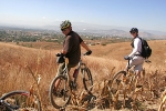
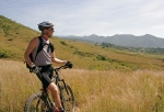
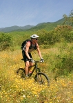
Huayapam is a small residential community nestled against the mountains a short distance from Oaxaca city. It is home to a number of resident expatriots from the U.S. and Canada. There are footpaths linking it with San Luis Beltran and San Felipe del Agua, two other villages that sit on the flanks of the mountains to the north of Oaxaca. These paths and other trails that lead into the hills are popular with the local mountain bikers.

The ride illustrated here covers 11.7 miles (18.8 km) and has an elevation gain of 2036 feet (620 meters). A good portion of that climb is connected with riding what we call the “road to nowhere,” an old logging road that runs up one side of a valley and down the other. You can avoid the climb and shorten the ride by skipping this part of the ride, if you like. There is also one creek crossing that requires dismounting to enter and exit an arroyo where it is a challenge to carry your bike down and up the steep side slopes. Otherwise, the outing is a blast!

Monte Alban

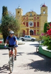
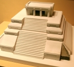
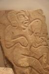
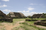
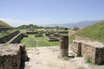
Monte Alban is the crown jewel among the archeological treasures of Oaxaca. Situated on a hilltop 1312 feet above the valley floor, the massive plaza with the imposing platforms that once held numerous temples and palaces is an impressive sight. Since it is quite close to the city of Oaxaca, it is easily accessible by bicycle.

The route traced on the map below runs for 11.3 miles (18.2 km) and shows an elevation gain of 1463 feet (446 meters). It is accomplished on paved roads all the way, so be cautious of vehicular traffic. The ride is rated “Moderate” because of the steepness of the climb. If you are a traveler from a low elevation, you will feel the strain of climbing at this altitude.

San Pablo Etla

San Pablo Etla is a small village on the northern outskirts of Oaxaca city. Like all the communities abutting the mountains around here, San Pablo lays claim to communal land rising from the town up the neighboring hillsides. In recent years (2008-2012) various people in the village have worked together to create a park on these shared lands. Volunteers have built a visitor’s center with parking lot, observation deck and zip line, along with several miles of hiking and biking trails in the park.

The map below shows a loop ride beginning in San Felipe del Agua going to the mountain park in San Pablo, with the return trip following a different route into downtown Oaxaca and thence up the hill to San Felipe. The outbound segment takes advantage of some of the many trails in the San Felipe bike trail network, gradually working up and over the hills and down into Viguera, where the the Camino Al Seminario leads up and into San Pablo. The return section follows the main highway connecting the various communities in the northern Etla valley with the capital. Obviously, you can ride the entire loop, or pick either half of the route according to your location and desire.

The entire loop runs 25.2 miles (40.5 km) and has an elevation gain & loss of 3370 feet (1027 meters). If you are leaving from central Oaxaca, you will save yourself considerable climbing by avoiding San Felipe and just riding along the highway to San Pablo. However, this way is not as scenic and has a lot of vehicular traffic.

San Pablo Etla Mountain Park – Loop 1

There are many trails in the communal park lands in San Pablo Etla that cry out to be ridden by mountain bikers. Shown below is a track utilizing a couple of these trails to form a loop. This loop ride is rated moderately difficult, both in terms of physical and technical challenges. It will give you a good workout and sharpen your bike handling skills. The ride is 12.4 miles (20 km) long and features an elevation gain / loss of 3370 feet (1027 meters). It is rated “Moderate to Difficult” because of its physical and technical demands.

The start / end point is the home of Carl Silverberg, a gringo who lived in the area for many years and worked hard to build this and other nearby trails. Sadly, Carl moved back to the U.S. in 2015. We miss his leadership and enthusiasm for mountain biking.

There is a user fee to access the park lands, which can be paid at the visitor’s center in the park.

Jalapa del Valle Ride

This is a fun, scenic and somewhat demanding ride from the Zocalo in downtown Oaxaca city through rolling countryside to the village of Jalapa del Valle and back.   It is essentially and out-and-back ride with a loop at the far end. All of the ride is accomplished on paved city streets, paved two-lane highway or dirt country roads. (Sorry, no singletrack!).

We started from the Zocalo in El Centro and concluded the ride by returning our rental bikes to the Zona Bici shop (Calle Garcia Vigil 406-1, just a couple of blocks north of the Zocalo). The distance covered is 27.5 miles (44.25 km), with an elevation gain of 2686 feet and a loss of 2566 feet (+ 818 / – 782 meters). I would rate this ride as moderately difficult, given its length and the steep grade of some of the hills.