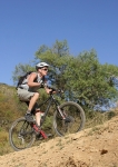
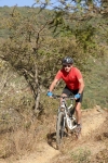
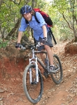
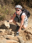
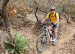
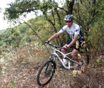
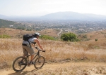
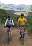
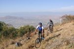
I went over to Etla to ride with a MountainBikeOaxaca.com tour today. Geoff and Glen(n) were in town visiting and deciding to go out with Carlos for a sampling of Oaxaca singletrack.

Category: Foothills
Foothills, GPS, Hiking, Mountains, MTBing, Ride Routes
San Pablo Etla Mountain Park – Loop 3
by Larry • • 0 Comments
There is an abundance of trails in the hills above San Pablo that are suitable for mountain biking. Here is another loop ride that is a variation on the theme established earlier with Loop 1 and Loop 2. The starting point and access routes are the same, but the lollipop loop that is the heart of this ride is different.
The biker attempting this ride will clock 9.1 miles (14.6 km) and find him or herself climbing and then descending a total of 2164 feet (650 meters) on mostly singletrack trail that winds through forested hillsides, often on rocky tread. The hardest climb, though, is on a dirt road that leads to the parking lot and community building at the new Mountain Park above San Pablo. After that, the grade of the singletrack trail is more moderate.
Foothills, GPS, MTBing, Outing, Trail Work
Scouting for an Etla to SFdA Connector
by Deron • • 3 Comments
After a short Thursday Morning No-Drop Group Ride with Larry and Judah, Carlos and I headed up Trail HFR to check on the post-rainy-season condition of Trail BK and to scout for possible singletrack trails to connect over to the trails Carlos and his amigos have built in the Etla hills. Our ride/scout GPS data is in grey, other trails and scouting efforts in the Viguera valley area are also included. In short, we didn’t find a way that gets us far enough north, but we were please to find Trail BK in such good condition and to be reminded how interesting and fun that trail is. We’re going to pursue pushing it on to the north and thus provide a bi-directional rideable route of singletrack. Care to help us?
To better examine these map items, instead of displaying a small map here, please load the map data in GoogleMaps (opens in a new window)
Here is the GPX file.
Here is the KML/KMZ version.
Foothills, GPS, MTBing, Outing, Photos
San Felipe – East Side Loop
by Larry • • 0 Comments
This is the second and more difficult loop ride utilizing various elements of the trail network in the hills above San Felipe del Agua. Our purpose here is to illustrate how a great ride can be had by stringing together some of the smaller trail segments described in the “Trails” page of this web site.
The paved (but never completed) road called the “Libramiento Norte” (LNR) is the main access to the entire trail complex. The jeep road labeled “Toro, Toro, Toro” (TTT for short) is the principal dirt trail leading up and into the trail network. The singletrack trail we call “High Flyer Ridge” (HFR) leads to the many steep, downhill-specific trails that plunge down into the forest from the ridge. Finally, it should be noted that none of these trails are in “Benito Juarez National Park,” which is located higher up the mountainside and may be closed due to an ongoing land dispute.
This loop, which stays in the forest on the east side of the Libramiento, offers a terrific ride – with lots of elevation gain, challenging runs through thick forest, technical, rock-strewn descents and several scenic overlooks. The loop covers 9.8 miles (15.8 km) and accumulates a total of 2482 feet (765.5 meters) of elevation gain & loss. The highest point on the trail tops out at 6906 feet (2105 meters). This outing is rated “Difficult” because of the terrain. Expect to complete the ride in from 2.5 to 4.0 hours, depending on the level of your strength, skill and stamina.
If you want to reference this loop with the trail segments listed on the “Trails” page of this web site, you will want to connect the following sections: (start) LBR to LNR to TTT to R to LNR to HFR to Ma to (unnamed) to M to LNR to LBR (finish).
Foothills, GPS, MTBing, Outing, Photos, Ride Routes
San Felipe – West Side Loop
by Larry • • 0 Comments
Colonia San Felipe del Agua is a favorite neighborhood for mountain bikers living in Oaxaca – whether gringo ex-pats or natives – because of the proximity of a network of great singletrack trails in the hills just above the community. It is a quick (if not exactly easy) ride from one’s front door to any of a number of satisfying trails. These are remnants of old jeep roads connecting San Felipe with Viguera; various pedestrian and animal paths; and some access trails created during the installation of a high-voltage power line across the mountains. The trails are often badly eroded and overgrown with vegetation, but they are generally rideable – if you can find them! And that’s where this web site comes into play. We’ve mapped the area so you can locate the trail that tickles your fancy on any given outing. Be forewarned, though: the trails are not marked, and can be difficult to find in heavy brush, even with a map. Your best bet is to download trail information into a GPS unit and have that with you when you go exploring the territory – or hook up for a ride with one of the locals who knows the area.
This particular ride is a loop that connects several of the individually-named trail segments found on the “Trails” page of this web site. It begins and ends at Colosio Park (intersection of Primero de Mayo and Loma Oaxal), covers 7.9 miles (12.7 km) and has an elevation gain & loss of 1750 feet (533.4 meters). While some sections are fairly steep and riding in the woods can be tricky, this outing is rated “Moderate,” as there are no serious technical challenges along the way. Expect to finish the loop in 60 to 90 minutes, depending on your biking ability and riding style.
Specifically, this route uses the following trails segments, which are detailed on the “Trails” page of this web site: (start) LBR to LNR to TTT to R to LNR to RR to WFR to SP to CM to LBR (finish).

