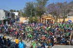
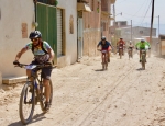
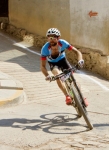
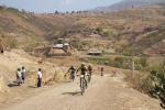
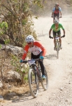
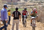
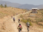
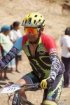
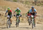
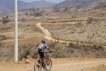
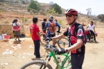
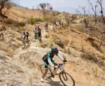
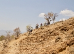
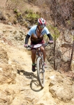
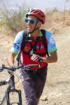
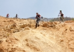
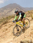
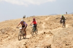
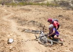
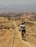
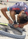
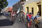
The mighty Titan Zapoteca marathon race held each spring in San Pablo Guila has become one of the premier mountain bike events in Oaxaca state. This year’s installment, which took place on Sunday, 26 March 2017, attracted over 400 registered participants — and a number of non-racing followers, like our little gringo group. As in past years, the race course was very challenging, with multiple long climbs and many treacherous descents. The race course is formidable, running for 42 km (26 miles) through the countryside, with steep climbs and scary, very technical descents. The total elevation gain and loss on the loop course amounts to over 1128 meters (3700 feet).
Category: Countryside
Countryside, Foothills, MTBing
Turf Battle – Rock: 1 / Tire: 0
by Larry • • 0 Comments
Another Sunday morning; another shop ride with the gang from Summit Cyclery. Just six fellows gathered today in front of the bike shop for the outing. Marco, one of the store managers, was present and would be the ride leader for the day. He was mounted on a slick new carbon fiber Rocky Mountain “Thunderbolt” 27.5-inch bicycle with a 1×11 drivetrain. At about 8:30 am we started pedaling at a leisurely pace in an easterly direction, riding city streets until getting out into the country. We continued heading east on unpaved roads, passing through Tlalixtac and then veered toward the foothills that form the northern rim of the Oaxaca Valley. We were headed into one of the several valleys that drain from the Sierra Norte. To this point the riding had been easy — the dirt roads were smooth and the terrain was flat — so no one had even broken a sweat. Then suddenly the road turned into a rock garden. Marco was in the lead and charged into the rocks with gusto. We all heard the “Pop!” and “Whoosh!” as the sidewall of his rear tire was punctured by a sharp rock. A quick examination showed a one-inch tear in the tire. Too bad, as the tire — like the bike — was brand new! It would have been a long walk back into Oaxaca if not for a number of plastic soda pop bottles littering the roadside. One of these was the right size to take a slice from the middle to make a splint to put inside the tire so an inner tube could be installed and inflated, making the bike rideable for the journey home. As the saying goes: “All’s well that ends well.”
Countryside, GPS, MTBing, Photos
Last Ride On My Specialized 29er
by Larry • • 2 Comments
Sunday, 12 March 2017 dawned in the usual fashion. Daylight savings time began in the U.S. overnight. (We do not move our clocks in forward in Mexico until April 2). The weather forecast for the day called for a high temperature in the low 80’s (Fahrenheit) with mostly clear skies. The Nitos Ciclistas en Movimiento club was planning to ride to Mitla and back — a worthy ride, indeed, but — at over 60 miles / 98 kilometers — farther than I cared to pedal today. So I put in an appearance at the Summit Cyclery shop to find out where their Sunday shop ride was headed. When everyone had assembled, we headed out in the direction of Huayapam. We rode 4.25 miles on city streets before catching a dirt road that links with the bike trail which runs along the base of the foothills north of town and connects San Luis Beltran, Donaji and Huayapam. From there we rode 8 miles into Huayapam and then out and back along the trail in Tlalixtac that wends up a mountain valley in the direction of El Estudiante and Tierra Colorada. Coming out of the hills, we arrived in Tlalixtac at about noon. I separated from the group at that point to take a more direct route back to Oaxaca and my home in San Felipe del Agua.
To this point the day’s outing was completely typical. But that was about to change, and rather drastically. On the last leg of my ride home I stopped briefly at a Pitico to grab an ice cream bar. I did not have a bike lock with me, but only planned to leave the bike for a minute or so. And that’s all it took for someone to grab my bike and ride away while I was buying my snack. So my favorite bike — a 2010 Specialized “Stumpjumper FSR Expert” 29’er — disappeared right under my nose. Ouch! You can now add my name to the long list of those who have had a treasured bicycle stolen. The moral of my sad tale is both simple and obvious: do not leave your bike unlocked and unattended for even a few minutes!
Countryside, MTBing, Outing, Photos
Oaxaca to Panama Ride
by Larry • • 0 Comments
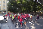
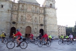
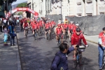
For the second year in a row a French cycling club has set up a weeks-long cross-country ride from Oaxaca to Panama. Working with local tour guides Pedro Martinez and Nicolas Garcia, the group of 40 Frenchmen set out from Oaxaca at 9 am on Sunday, 29 January with a police escort and accompanied by riders from the local Nitos Cyclistas En Movimento mountain bike club. On the first day of their epic ride they planned to stop briefly in San Bartolo Coyotepec, Tilcajete and Ocotlan de Morelos, finishing for the day and staying overnight in Ejutla. Over the next several weeks they will pedal through the states of Oaxaca and Chiapas and tour the Yucatan Peninsula before riding through Belize, Guatemala, El Salvador, Honduras, Nicaragua and Costa Rica before reaching their destination of Panama City, Panama.
Countryside, GPS, MTBing, Photos
Mountain Bike Race At San Antonino
by Larry • • 0 Comments
San Antonino is a village in the shadow of Ocotlan, perhaps the most famous town in the Zimatlan Valley to the south of Oaxaca city. It is noted for the fine embroidery work done by the ladies of the community and for the extravagant floral displays put on in the cemetery during the “Day of the Dead” celebration every year on November 3rd. On this particular Sunday in December the town sponsored a mountain bike race, which attracted over 250 registered participants representing bike clubs from all around central Oaxaca state. The race course was a 4.9 mile (7.88 kms) loop laid out in the rolling countryside on the south side of town. There were two significant hill climbs, with subsequent sharp descents (with downhill gradients of up to 16% and 24%, respectively), built into the loop. Riders had to make it up a total of 720 feet (219 meters) in elevation gain each time around the course. Racers in the Elite category had to ride the loop four times. Those in the various Masters classes had to go around three times. Women and riders in the Aficionado class had to make the circuit two times. As always, there were plenty of spectators on hand, and the people of San Antonino provided lots of food and beverages to reward participants after the race.
