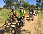
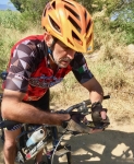
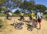
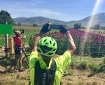
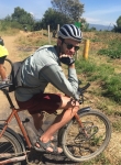
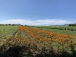
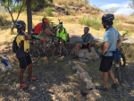
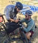
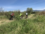
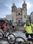
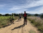
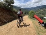
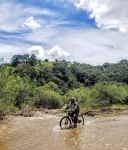
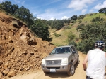
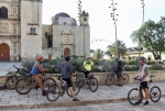
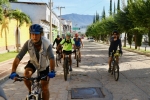
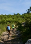
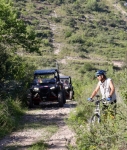
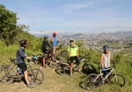
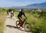
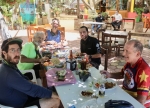
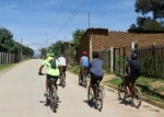
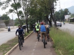
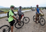
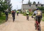
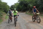
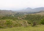
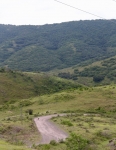
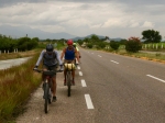
Mexico switched from daylight savings to standard time overnight, so although our group ride started at the same time by the clock, the day was an hour older. That gave people more time to get going and the sun longer to burn off the morning chill. Seven fellows showed up at the rendezvous point for a pleasant ride into the Zimatlan valley to the south of Oaxaca city. Our original destination was the village of Santa Ana Zegache, where flowers are grown for the Day of the Dead festivities. We thought we would find lots of color in the farm fields thereabouts. It was a gorgeous day to be out on a bike. However, we did not find as many fields of flowers as we expected and we did not quite make it all the way to Zegache. Instead, we were content to turn around at the gigantic figure of a danzante which stands atop a hill overlooking Zimatlan, 4.5 miles short of Zegache. The group stopped for lunch and cold drinks at a convenient curb-side comedor coming back into the city. Here are the stats for the day’s outing: Round trip distance – 33.3 miles / 53.6 kms Elevation gain and loss enroute – 840 feet / 256 meters Elapsed time – just under five hours.
Category: Countryside
Countryside, GPS, MTBing, Photos
Still Pedaling
by Larry • • 0 Comments
With the arrival of October it was as though someone turned off the spigot. Where September 2020 was unusually wet, October has turned out to be quite dry – which is in keeping with the historical switch from the rainy to the dry season at the end of September. On this 18th day of October the landscape is still lush and green, and now fall wildflowers are in full bloom across the Valles Centrales. The wild marigolds may go unpicked this year, though, because the coronavirus pandemic is still running at full gallop and most public Day of the Dead events have been cancelled. Local families will doubtless still construct the traditional ofrenda in their homes, but the time-honored tradition of decorating graves and celebrating the season with noisy comparsas in various neighborhoods will be muted, at best. Our group of expat mountain bike riders continue to schedule regular weekly rides, though. The outing this Sunday was essentially a repeat of the loop ride of August 30 (see “A Ride In The Country” reported below) except we rode the circuit in the reverse direction just to be different. Alee, a bike-packer pedaling from Argentina to Alaska, was in town and joined in today’s outing. There are now six such long-distance riders recuperating in Oaxaca before continuing their epic journeys. We enjoy their company on the trail and are fascinated by their tales of seeing the world from the viewpoint of a bicycle saddle. Alee hales from Australia and has bicycled across all five continents. Today’s ride of 24 miles (38.6 kms) was but a drop in his bucket and he hardly broke a sweat, even on the gnarly sections of steep jeep road. Ride on!
Countryside, GPS, MTBing, Photos
Ride to Jalapa del Valle
by Larry • • 0 Comments
The summer of 2020 will go on record as one of the wettest in recent memory. Since June we have had consistent cloud cover over the Valles Centrales, with frequent rain showers both day and night. As a result, farmers are delighted to have excellent crops and the mountains are as lush and green as can be. The concern now is that fields are saturated and so harvesting the crops may be problematic. Oaxaca city received 6.8 inches (17.3 centimeters) of rain over the past five days, so bike riders encountered numerous puddles and lots of mud along country roads today, and not a few landslides on steep hillsides. Needless to say, streams and rivers were running fast and presented some challenge to cross. That said, we had mostly clear skies for our ride this Sunday morning in late September. Our destination was the village of Jalapa del Valle, located along the Rio Jalapilla about 11 miles (18 kms) to the west of the city. We were a small band of four riders as we set out at 9 am from the plaza in front of the church of Santo Domingo. For the outbound part of the loop ride the group chose the less strenuous of two routes crossing the ridge of hills between San Pedro Ixtlahuaca and Jalapa del Valle, then opted for the easy way home along the river valley roads passing through La Union, San Felipe Tejalápam and Atzompa. The stats for today’s excursion are as follows: distance ridden – 36 miles / 58 kms; elevation gain and loss – 2501 feet / 762 meters; high point on the ride – 6239 feet / 1901 meters; time in the saddle – 5.5 hours, counting a snack break in Jalapa del Valle.
Countryside, GPS, MTBing, Photos
A Ride In The Country
by Larry • • 0 Comments
This Sunday dawned with mostly blue skies – the first morning in several weeks without heavy cloud cover. Our core group of regular riders was augmented by two newcomers to Oaxaca. Jake is bike-packing from the U.S. to South America with his girlfriend and stopped for a few weeks in Oaxaca to rest and enjoy the scenery. Brian arrived a few days ago with the intention of making Oaxaca his home for a year or so. Both were eager to explore the territory and were welcome to ride with us. Brian is a roadie and so was unaccustomed to riding a mountain bike. Jake’s rig was outfitted for touring. So today’s outing was laid out to give them a taste of different treads – pavement, country road and jeep trail – over terrain that would offer some challenges but not be overwhelming. After meeting at 9 am in central Oaxaca we road to Tule, using a jeep road that swings up and over a ridgetop before dropping into the flat terrain of the Tlacolula Valley. From Tule we rode on pavement to Santo Domingo Tomaltepec and then returned to Oaxaca via dirt roads that took us through Tlalixtac. Nearing the capital we veered off to Huayapam to stop for lunch at a restaurant with a patio on the shore of one of the two presas that store water for the residents of Tlalixtac. The outing was most enjoyable, marred only by the rear derailleur cable breaking on Brian’s borrowed mountain bike. He had to make his way back to town with the use of just the three different gear ratios provided by the front triple chainring. All told, the group covered 24.1 miles (38.8 kms) with an elevation gain and loss of 1611 feet (491 meters) on the loop ride. The high point of the trail was the top of the ridge, which registered 5515 feet (1681 meters) on the GPS unit. Counting the hour or so spent enjoying lunch, the group was on the trail for about six hours.
Countryside, GPS, MTBing, Photos, Uncategorized
How Far Will You Pedal For Lunch?
by Larry • • 0 Comments
It rained Saturday afternoon and evening in Oaxaca (ninety-five hundredths of an inch) and Sunday dawned overcast and gloomy. The day’s suggested ride was a long one that would take about seven hours to complete, so anxious eyes were cast skyward. There were no rain clouds in sight at 9 am, so the group of four riders decided to proceed as planned. The proposed route was a loop that could be ridden in either direction. After some discussion, the band opted to pedal clockwise, so the itinerary took the riders from Oaxaca to Tule, Rojas de Cuauhtémoc, San Juan Teitipac, Santa Cecilia Jalieza, then over the hill to San Pedro Guegorexe and to the Azucena Zapoteca restaurant near Tilcajete for lunch. After their meal the group would decide whether to return to Oaxaca on Hwy 175 or stick to country roads that would take them through San Martin Tilcajete, Santa Ana Zegache and Zaachila. The highway option would be about 20 kilometers shorter, but would entail a climb up and over a ridge of hills. Following a very pleasant lunch, the fellows opted for the shorter (highway) route home. When the ride was complete, the day’s numbers were tallied. Riders pedaled 44.5 miles (71.6 kms) with an elevation gain and loss of 2320 feet (707 meters) on the circuit. The high point was the top of the ridge separating Santo Domingo Jalieza and San Pedro Guegorexe, which registered 5895 feet (1797 meters) on the GPS unit. From there it was a quick vertical descent of 818 feet (249 meters) on 4.2 miles (6.7 kms) of dirt road into the valley. Tlaloc, the ancient god of rain, looked with favor on the bikers and held off rain showers until all were safely home.
