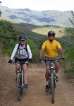
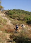
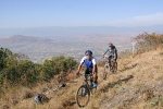
Colonia San Felipe del Agua is a favorite neighborhood for mountain bikers living in Oaxaca – whether gringo ex-pats or natives – because of the proximity of a network of great singletrack trails in the hills just above the community. It is a quick (if not exactly easy) ride from one’s front door to any of a number of satisfying trails. These are remnants of old jeep roads connecting San Felipe with Viguera; various pedestrian and animal paths; and some access trails created during the installation of a high-voltage power line across the mountains. The trails are often badly eroded and overgrown with vegetation, but they are generally rideable – if you can find them! And that’s where this web site comes into play. We’ve mapped the area so you can locate the trail that tickles your fancy on any given outing. Be forewarned, though: the trails are not marked, and can be difficult to find in heavy brush, even with a map. Your best bet is to download trail information into a GPS unit and have that with you when you go exploring the territory – or hook up for a ride with one of the locals who knows the area.
This particular ride is a loop that connects several of the individually-named trail segments found on the “Trails” page of this web site. It begins and ends at Colosio Park (intersection of Primero de Mayo and Loma Oaxal), covers 7.9 miles (12.7 km) and has an elevation gain & loss of 1750 feet (533.4 meters). While some sections are fairly steep and riding in the woods can be tricky, this outing is rated “Moderate,” as there are no serious technical challenges along the way. Expect to finish the loop in 60 to 90 minutes, depending on your biking ability and riding style.
Specifically, this route uses the following trails segments, which are detailed on the “Trails” page of this web site: (start) LBR to LNR to TTT to R to LNR to RR to WFR to SP to CM to LBR (finish).


